The north trail head of the popular Sand Canyon Trail is west of Highway 491 on County Road N near Cortez in southwest Colorado. About 1.2 miles west of the Sand Canyon Trailhead, the County Road re-enters the Canyons of the Ancients National Monument.
About 3.6 miles west of the entry sign, there is a cleared area with some gas facilities and a good view along the south rim of Burro Canyon.
From this starting point the Burro Canyon area looks like two parallel canyons with two high mesa top islands in between. The terrain here appeared to be all Pinon Pine and Utah Juniper forest with no obvious sage brush fields down below. There are large power lines along the well maintained gravel road that are helpful for navigation.
I chose to hike toward the south facing cliffs on the mesa top island that looked to be about 1 mile north and slightly east. There isn’t a trail here except for deer trails but the forest is open enough for reasonable hiking. As I got closer, there appeared to be a rubble pile in the east end of the mesa top island and some wall sections in the area below the rim. There is a climb up through a boulder area to get up to just below the rim.
There are several rough wall sections and a moderate sized site below the rubble pile. About 20 yards to the left of the lower site there is a notch that makes climbing to the rim easy. The upper site has a better wall section that can be seen from below and excellent views across and down the canyon.
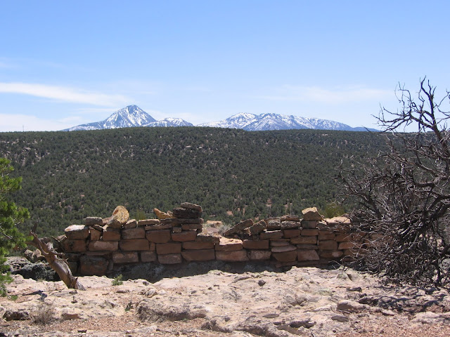
The structure is on a boulder with a gap separating it from the main cliffs. This site certainly has the appearance of a lookout point. The start point for this hike is clearly visible across the canyon.
It is only about 200 yards across the island mesa top to the north rim and the views across. I was surprised to spot a similar boulder top structure on this north facing rim with some masonry work around the base and a log leaning as if it were a ladder. This site is slightly below the highest rim, requiring a search for a notch to get through a short cliff layer.
From the north rim it is a short walk to the west rim and a view down canyon toward the junction with Yellowjacket Canyon. Several of the regional mountain ranges are visible from these mesa top view points, There is an old road in the area below that lead up to another mesa top island. I think the old road starts somewhere along the south rim, dips down into Burro Canyon and then climbs toward the mesa top island.
On the return east along the rim toward the first mesa top site I spotted another site that is about 200 yards to the west of the first site. I only looked at this site from the rim. It isn’t very visible from below.
It took me 2:00 hours to reach the first ruins site, but I spent much of that time looking and scanning and deciding which way to go. I spent 1:00 hour viewing the sites and the return hike took 1:00 hour for a total of 4:00 hours for about 4 miles of hiking. I carried and drank two liters of water on a 60 F degree late April day.


