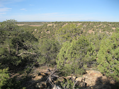
The Mockingbird Mesa area in the Canyons of the Ancients is 8.5 miles south on County Road 12 from the junction with County Road BB, west of Pleasant View in southwest Colorado. The route zig zags and the road numbers change before arriving at the normally closed gate near a carbon dioxide gas plant.
Starting out to the south parallel to the main road, there is a cleared swath of Pinon and Juniper forest that leads about 0.5 miles to a rubble pile Ancestral Pueblo ruins site. Keep an eye out for it along the west edge of the cleared area. The site is not visible from the main road.
This site and another similar site that is on the east side behind the carbon dioxide plant are the easiest to find and visit in the north part of the Mockingbird Mesa area. From this site, I hiked directly west a short distance to the mesa top rim that overlooks Negro Canyon.
I arrived at the head of a side canyon. Scanning with binoculars, there is a rubble pile visible on the north side of the side canyon near the point. It took me a total of 0:45 minutes to arrive at the site.
The first structure visible on the east side of the site looks like a square tower. A wall segment on one side is still standing with the outline of an adjacent side.
A lot of rubble has collapsed into the interior of the room and some is flowing down the slope.
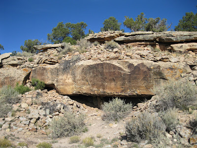
Further along there is a small alcove that appears to be the center of the site. The thick roof of the alcove acts as a foundation as well as a roof. Inside the alcove there are some small preserved wall sections. Like many Canyons of the Ancients sites, this village is partly on the canyon rim and partly just below the rim.
The view from the site is toward the south along the west rim of Mockingbird Mesa. There is some private property on the floor of Negro Canyon. Scanning from here, I didn’t notice any more ruins sites.
I returned back along the rim and continued south to the second side canyon. The terrain on the second side canyon seemed similar but I didn’t notice any more sites. The second side canyon has an old road trail that crosses the floor and climbs the south side.
I considered descending and crossing below but decided to stay along the rim. On the south side the trail that crosses can be found connecting to the main road. This junction is just south of a cattle guard and a barbed wire fence, about 2 miles south of the gas plant. A short distance from the main road, this trail has a side trail that continues southwest.
I followed the southwest leading trail for 0:45 minutes through the forest until it arrived at a third long side canyon that angles back to the northeast. I looked along the rim of this side canyon for about 1:00 hour but didn’t notice any ruins sites.
Following along the rim led back toward the main road. This part of the hike between the second and third side canyons turned out to be a loop. The return hike along the main road took about 0:45 minutes. My total hike took 5:25 hours for 9 miles. I carried and drank 3 liters of water on a 60 F degree late October day.


No comments:
Post a Comment