Mockingbird Mesa is located 7.2 miles south along County Road 12 from the junction with Road BB to a left turn. Continuing past this turn for 0.9 miles and turning left it is 1.3 more miles to a locked gate and the west side of the upper part of Negro Canyon.
This is the south end of the road labeled 4531a on the Canyons of the Ancients park map. This area is west of Pleasant View in southwest Colorado.
The only direction to hike at this point is to the west. There is a cleared swath of Pinon Pine and Juniper forest along a carbon dioxide pipeline. There is also an east and west fence close to the pipeline route. I followed the pipeline route west, crossing several minor drainages that appear to be side canyons of Negro Canyon.
After about 1.2 miles and 1:00 hour of slow walking I arrived at the minor dirt road that leads to the private Hovenweep Ranch. I had wandered off the pipeline route to look at the heads of the minor drainages in this area but didn't notice anything interesting.
The east and west fence along the north side of the Hovenweep Ranch is the same fence that is visible near my starting point and I decided to follow it back. There is a vague cow trail most of the way along the fence.
A short distance back east along the fence, there is a semi-circular rubble pile visible. This site is somewhat vague as a structure but there are many pottery shards visible scattered near the rubble.
One of the pottery shards was rectangular shaped and had a hole drilled into it. The area museums have displays of shards similar to this and they identify these as pendants. This is the first shard like this that I have noticed in the field. ( It is still there).
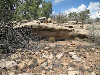
Continuing along the fence and crossing the low point of this drainage, then climbing up the east slope, there is another small ruins site with a small rubble pile and some large stones piled on a boulder.
This same site also had a large semi-circular structure that had higher walls and a deeper depression in front of it than the previous site . This structure might be a full circle, but the south side wasn’t as obvious as the north side.
This site also had many pottery shards. From this site it was about 0:30 minutes to return to the starting point. My total hike took 2:20 hours for about 2.5 miles. I hiked on a 66 F degree late September day.


No comments:
Post a Comment