Friday, March 30, 2012

Woods Canyon North


An access to the north end of Woods Canyon in the Canyons of the Ancients can be found at the junction of County Roads U and 14, west of the community of Yellow Jacket in southwest Colorado. Turn west off of Highway 491 onto County Road Y at Yellow Jacket. Continue west for a few miles to County Road 15 and turn south.


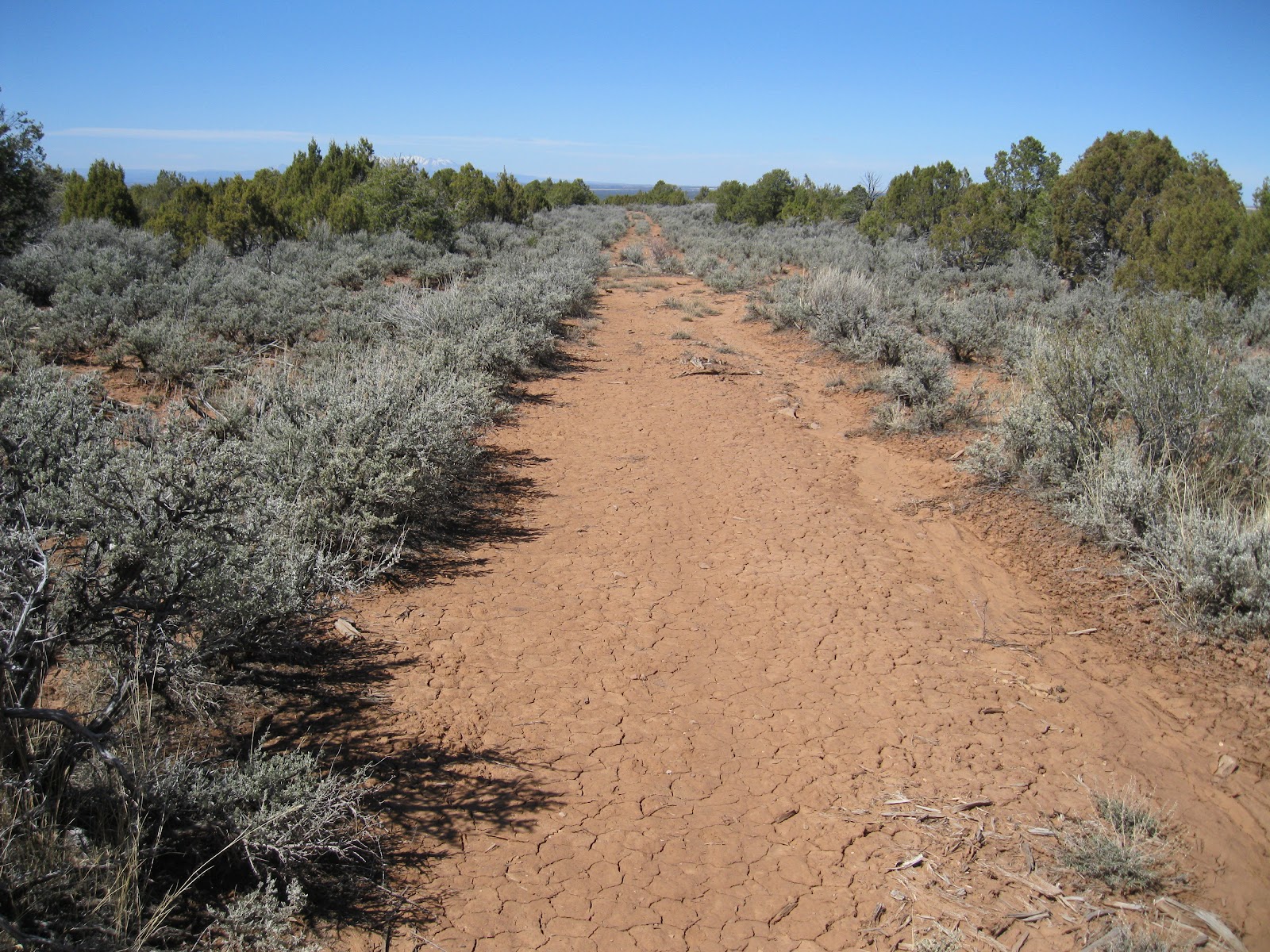
Across the road from the Carbon Dioxide gas plant there is room to pull off the gravel road and park by the Canyons of the Ancients sign. There is an old road starting here that leads down for a relatively easy descent into this canyon. There is a gate in the fence back to the east if you can’t climb over the fence.


The road leads to the bottom of a canyon that appears to be a short side canyon of Woods Canyon. The trail continues north and west down the side canyon to the main canyon where there is a junction with trail segments going northeast and southwest. I continued northeast, up the main canyon. To the south there are some major power lines crossing high above the canyon. The somewhat well known Woods Canyon Pueblo is to the south of this trail junction.


The road north seems to fizzle out after about 0.5 miles from the junction. There are two main branches of the head of Woods Canyon. Scanning ahead with binoculars, I could see some large boulders with  rubble on the top about 0.5 miles ahead on the west side of the eastern branch.

There are cow trails that continue along the creek bottom to the area below these large boulders. The ruins site is hard to see from the trail so you have use the background cliffs as a guide.


There is quite a bit of flowing water in the creek bottom, with even bulrush growing here in the summer. Besides the Pinon Pines and Utah Juniper there were large patches of Gambel Oak in this canyon. This seemed like a promising habitat, relatively lush with vegetation.


This south facing site seemed to be a large one, spread out around several very large boulders and against the canyon rim cliffs, making use of some modest alcoves. I didn't see an easy trail up toward the canyon rim but most hikers should be able to make it up. The rubble piles around the site were pretty extensive and there were several circular depressions with extensive rubble that the amateur would guess were kivas.


The builders made use of the gaps between the boulders as well as the alcoves against the cliffs. I didn’t see any easy way to get all the way to the top of the canyon rim from the ruins site. Some of the sites in the area have structures on the rim and more that spill down the canyon side. Here, I couldn't see anything on the rim.


Except for the rubble on top of one of the large boulders, this site would be hard to spot from the distance. The remains are mostly rubble piles and are hidden by the thick forest. It wasn't possible to step back and get a good overall view. To visit the site I had to wind around all the tall boulders and trees, without seeing what was ahead.

On this hike I also looked around the western arm of the canyon head and a little on the mesa top area between the two arms of the canyon head, but without noticing any other ruins sites. A hike to just this ruins site would take about 3:00 hours for about 4 miles With my exploring and scanning and visiting the site my total hike took about 5:30 hours. I carried 2 liters of water on an 65 F degree mid March day.


Sunday, March 25, 2012

Morrison Canyon North Rim

Morrison Canyon is a major side canyon of Trail Canyon on the southeast side of the Canyons of the Ancients National Monument in southwest Colorado. This part of the Canyons of the Ancients was acquired in 2004 and was formerly part of the 2000 acre Trail Canyon Ranch.

The access I used started at the junction of County Road P and County Road 18, west of Highway 491, and continued south on Road 18 until it made a west turn and there is a green gate visible. The last mile of County Road 18 is a rough dirt road. This access is shown on the current Canyons of the Ancients maps available at the Anasazi Heritage Center Near Dolores, CO. Older maps will show this area as still private property. 

There is an old road inside the green gate that leads east for a short distance, and then a rougher trail leads southeast and arrives at the west rim of Trail Canyon after about 10 minutes of hiking. I looked around this canyon rim for about 0:40 minutes without noticing any Ancestral Pueblo ruins sites, and then returned to the starting point.
The advantage of returning to the starting point is that you can hike south around the heads of two side canyons without having to descend and climb out again. I walked parallel to a fence that runs north and south. After 0:10 minutes of hiking I noticed a small array of sharp edged rocks that seemed to be in a completely random location. I didn't see anything that resembled a ruins site in the vicinity. It was as if someone had decided to abandon their collection on a convenient ledge.
About 0:15 minutes further on there is a low block dam on a wide sandstone outcrop. This looked like the work of ranchers, but they could have been making improvements on a more ancient work. I think there is a small lake near the Goodman Point Pueblo where ranchers made upgrades to much older structures. Mummy Lake at Far View on Mesa Verde is an example of Ancestral Pueblo water supply engineering.

I stopped at the north rim of Morrison Canyon where there are steep cliffs in the vicinity of the fence. The Canyons of the Ancients continues across the canyon and there may be access to the east rim of Goodman Canyon on the other side. Sleeping Ute Mountain is poking its head up beyond the mesa top.

The online article describing the Morrison Canyon area mentions that there are ten important archaeological sites including pit houses, a pueblo, a granary, and a field house. The area also provides wildlife habitat and is an important part of the McElmo watershed.
On the return hike I noticed a rubble pile site along the fence line about 0:15 minutes of hiking directly west of my starting point. This rubble pile was very overgrown with sage brush and had some ranching artifacts mixed in with the rubble. My total hike in the MorrisonCanyon area took 3:50 hours for 3 or 4 miles on a 68 F degree late March day. I carried and drank 2 liters of water. This appeared to be an area that gets very few visitors.

Friday, March 23, 2012

Burro Canyon south to Moccasin Canyon

The area south of the southwest side of Burro Canyon is part of the Moccasin Canyon drainage in the Canyons of the Ancients in southwest Colorado. An unmarked rough road provides a good hiking trail leading south into this area. 

The trail is 4.8 miles west of the Canyons of the Ancients entrance sign on the west extension of County Road N. This entrance sign is 1.2 miles west of the north trailhead of the popular Sand Canyon Trail.

At this same starting point, there is also a trail into the southwest part of Burro Canyon, marked as Road 4526 on the north side of the main road. The south leading trail descends through Pinon Pine and Juniper forest with good canyon views to the south. This route appears to get some ATV use.


There are several side roads off of this trail. After about 1:00 hour of hiking there is a Y junction that can be used to make a loop hike. I stayed to the left and ended up returning on the right. The terrain changes as the elevation drops with more sagebrush and grassland. The area has a dry look and I didn’t see any sign of seeping water here.
The trail makes the loop turn at the base of a small rocky mesa. Up to this point, I hadn't noticed any Ancestral Pueblo ruins sites and I thought this mesa top would be the most likely place to look before turning back. I was 1:45 hours into my hike when I arrived on the mesa top.

There is a slightly higher hilltop connected to the mesa top. Along the south facing rim of the mesa top are some of the rocky sheltered spots that seem to be often used as building sites, but I didn’t notice anything. The scenery is very dramatic in all directions.

I spent about 1:00 hour looking around on the mesa and hilltop, mostly enjoying the wide views. I saw a place on east end where some rocks were stacked into a low wall but it didn’t look like a ruins site. I didn’t see any pottery shards anywhere along this hike.

To the southwest I think the spires of Monument Valley are visible. The Bears Ears in southeast Utah can be spotted from this high viewpoint.  From the hilltop the other side of the loop trail is visible. It took me 2:20 hours to return to the starting point for a total hike of 5:00 hours for about 6 miles. I hiked on a 56 F degree late March day and carried 2 liters of water.

Sunday, March 18, 2012

Burro Canyon Southeast

The access to the Burro Canyon area of the Canyons of the Ancients is along the west extension of County Road N, northwest of Cortez in southwest Colorado. About 1.2 miles west of the north trailhead of the popular Sand Canyon Trail, the road there is a sign marking the re-entrance to the Canyons of the Ancients.

I started hiking at the sign and started north into the Pinon Pine and Juniper forest, looking at the hilltops and a long side canyon that leads north to Yellowjacket Canyon.


I worked west slowly and eventually came across a small Ancestral Pueblo ruins site that overlooks the main road about 0.8 miles west of where I started. Along the road there is a cattle guard with a vague trail leading uphill along a fence. I stated to see pottery shards about 100 yards up this trail and followed the clues uphill to find the rubble pile.
I didn’t see any intact walls but the locations of these sites are usually interesting. This site is in a sunny location at a relative high point and has a rocky outcrop as a foundation.

I saw what looked like a small display of stone tools. These rocks all have sharp edges or sharp points and appear to use several different minerals. Small arrays of pottery shards are common around these seldom visited sites but stone tool displays are unusual. I don’t know for sure that these are tools but they look like they could be. I looked around this area for a total of 2:45 hours before returning to my vehicle and moving further down the road. If you start in the right place, this site can be hiked to in only a few minutes.

The main road makes a sharp turn to the right about 1.7 miles west of the Canyons of the Ancients entry sign. Just before this turn there is an easy to miss overgrown old road that runs parallel to the main road for about 1 mile and then rejoins.

About 100 yards down this old road there is an overgrown rubble pile ruins site. It appears that this segment of road was re-routed to avoid this and another similar site that is about 10 minutes of walking further.
The second site is so overgrown that no rubble is visible from the old road. The clues for this site are that sagebrush growth seems to be mounded and there are some vague pottery shards along the road. Pushing into the brush, there appear to be several rubble pile structures. This site appears to be larger than the one that is closer to the main road. There are more old roads to explore further west along the south side of Burro Canyon.

In March 2012 there is some gas well drilling visible on the north side of Burro Canyon and some pipeline installation in progress. The Canyons of the Ancients sits over a large reservoir of Carbon Dioxide that is piped mainly to west Texas and aids in oil recovery. The road improvements that aid the gas well activity also aid access to these interesting backcountry canyon areas. I spent about 1:00 hour on this short side road to the two rubble pile sites on a 60 F degree mid March day.

Sunday, March 11, 2012

Alkali Canyon Northwest

Alkali Canyon is a tributary to McElmo Canyon on the southeast side of the Canyons of the Ancients National Monument in southwest Colorado. The access I used was a west turn onto County Road N off of Highway 491, then a south turn on County Road 20. This area is northwest of Cortez, Colorado. This access is shown on the current Canyons of the Ancients maps that are available at the Anasazi Heritage Center near Dolores, CO.

At the end of County Road 20 there is a wide circular turn around area. The access is confusing as there are No Hunting signs for the adjacent private property, but no signs indicating that the area to the southeast is part of the Canyons of the Ancients. I think this a recent acquisition as it doesn’t appear on older maps. From the starting point, there is a wide sagebrush and grassland area extending south with Pinon Juniper forest to the east. The west rim of Alkali Canyon is directly east about 1 mile away.

I started hiking east toward the forest close to the fence line. After only a few minutes of hiking there is a rubble pile Ancestral Pueblo ruins site that is somewhat overgrown with sagebrush. This site is located at a relative high point and has good views of the surrounding mountains including Sleeping Ute Mountain.

I continued east through the Pinon Juniper forest for 0:40 minutes before arriving at the west rim of Alkali Canyon. I scanned with binoculars but didn’t notice any structures from this view point. From this point I walked along the rim for about 0.5 miles south and then turned back west to the grass land area.

About 1 mile southeast of the starting point there is a hilltop area with sagebrush and a few trees. In this area there are some old ranch roads that lead into forest and also to the south.

On the hilltop area I noticed many pottery shards but didn’t see anything that I was sure was a ruins site. From this hilltop the starting point and the rubble pile site were in view. My four mile hike took 2:30 hours and covered the most northwest square mile of the several square miles surrounding Alkali Canyon. I hiked on a 50 F degree early March day. There were a few patches of melting snow in the shady forested area.