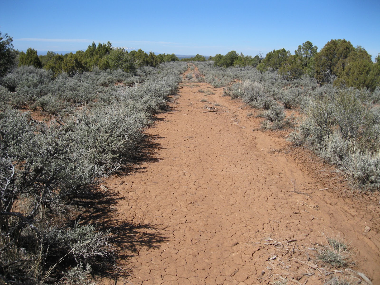
The access to the Burro Canyon area of the Canyons of the Ancients is along the west extension of County Road N, northwest of Cortez in southwest Colorado. About 1.2 miles west of the north trailhead of the popular Sand Canyon Trail, the road there is a sign marking the re-entrance to the Canyons of the Ancients.
I started hiking at the sign and started north into the Pinon Pine and Juniper forest, looking at the hilltops and a long side canyon that leads north to Yellowjacket Canyon.
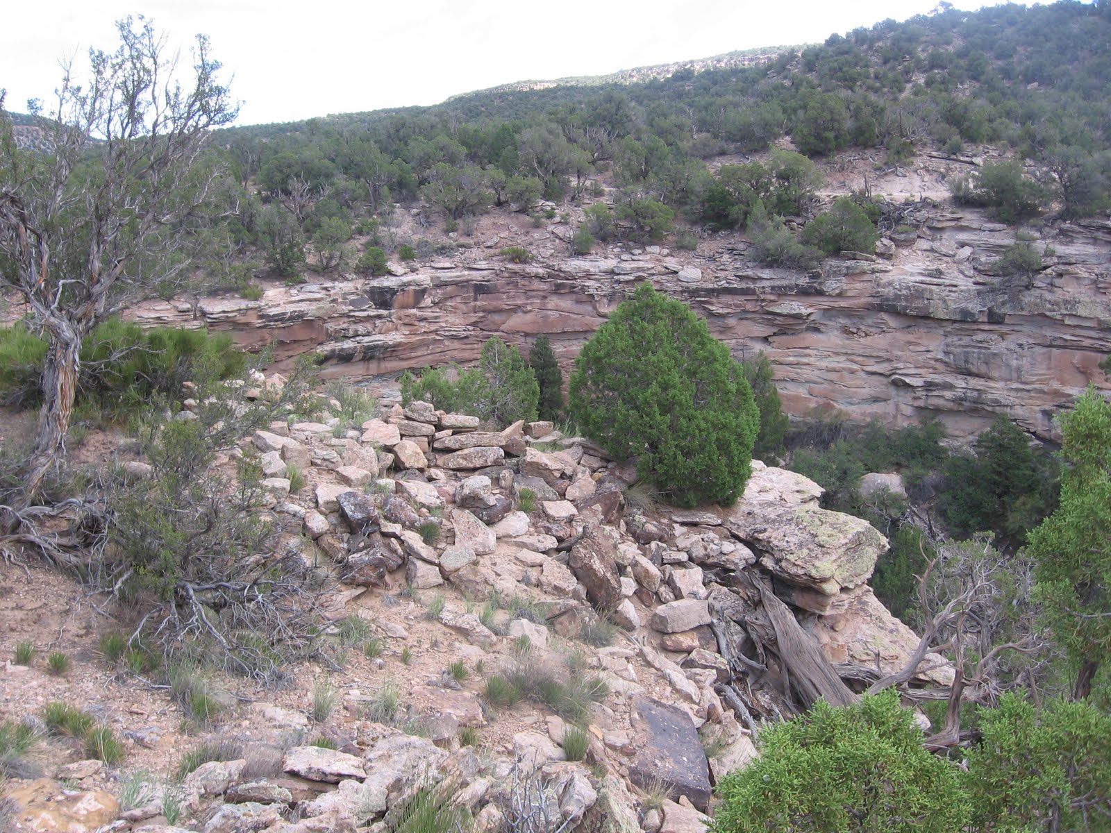
I worked west slowly and eventually came across a small Ancestral Pueblo ruins site that overlooks the main road about 0.8 miles west of where I started. Along the road there is a cattle guard with a vague trail leading uphill along a fence. I stated to see pottery shards about 100 yards up this trail and followed the clues uphill to find the rubble pile.
I didn’t see any intact walls but the locations of these sites are usually interesting. This site is in a sunny location at a relative high point and has a rocky outcrop as a foundation.
I saw what looked like a small display of stone tools. These rocks all have sharp edges or sharp points and appear to use several different minerals. Small arrays of pottery shards are common around these seldom visited sites but stone tool displays are unusual. I don’t know for sure that these are tools but they look like they could be. I looked around this area for a total of 2:45 hours before returning to my vehicle and moving further down the road. If you start in the right place, this site can be hiked to in only a few minutes.
The main road makes a sharp turn to the right about 1.7 miles west of the Canyons of the Ancients entry sign. Just before this turn there is an easy to miss overgrown old road that runs parallel to the main road for about 1 mile and then rejoins.
About 100 yards down this old road there is an overgrown rubble pile ruins site. It appears that this segment of road was re-routed to avoid this and another similar site that is about 10 minutes of walking further.
The second site is so overgrown that no rubble is visible from the old road. The clues for this site are that sagebrush growth seems to be mounded and there are some vague pottery shards along the road. Pushing into the brush, there appear to be several rubble pile structures. This site appears to be larger than the one that is closer to the main road. There are more old roads to explore further west along the south side of Burro Canyon.
In March 2012 there is some gas well drilling visible on the north side of Burro Canyon and some pipeline installation in progress. The Canyons of the Ancients sits over a large reservoir of Carbon Dioxide that is piped mainly to west Texas and aids in oil recovery. The road improvements that aid the gas well activity also aid access to these interesting backcountry canyon areas. I spent about 1:00 hour on this short side road to the two rubble pile sites on a 60 F degree mid March day.
Trails visiting Ancestral Pueblo Ruins in the canyon country along the southern Utah-Colorado border. Includes the remote sites of Hovenweep National Monument, the relatively well known Sand Canyon Trail system, and many wild hikes to little known hidden sites. Notes and Pictures. Hike for fitness and environmental awareness.
Showing posts with label Burro Canyon. Show all posts
Sunday, March 18, 2012
Wednesday, August 25, 2010
Burro Canyon Southwest Trail
The lower and southwest end of the Burro Canyon area, in Canyons of the Ancients in southwest Colorado, can be explored along an old road that descends from the south rim and crosses to the mesa top area between the two apparent parallel canyons.
The old road curves back to the west and runs along the south side of a large sky island, then continues out to viewpoints overlooking Yellow Jacket Canyon. There aren’t many official trails in Canyons of the Ancients, but the old roads often make good routes through these wild canyons.
It then follows the canyon bottom east for about 1 mile before climbing out to the mesa top. Looking across, there are several grassy areas on the mesa top area near the sky island. About half way down, another trail splits off, heading west down canyon. At the canyon bottom, the trail passes a very large pour off point.
There is a small Ancestral Pueblo ruin site perched on the rim overlooking the pour off. The site can be viewed from the trail and it is only a short hike to get a closer view.
This small site looks like it might have been a circular tower. I didn’t see any other structures associated with this site. My hike continued up canyon and onto the mesa top, and out to the point overlooking Yellow jacket Canyon. Despite the scenic canyon country and some reasonable looking locations, I didn’t see any more ruins sites in this area.
Hikers interested mostly in ruins sites could stop at the canyon bottom and return to the rim. There are several ruins sites to find at the upper end of Burro Canyon, so I was disappointed not to find more in the lower end.
It took another 1:50 hours of hiking to get to a point, west of the sky island, where there are views in both directions of Yellow Jacket Canyon. The Yellow Jacket Canyon bottom view down canyon has some roads and farming activity and is mostly private property. The trail continues further than I went, at least another 0.5 miles out to a point more in the middle of Yellow Jacket Canyon.
The view up canyon has some sandstone outcrops that I scanned, looking for the Yellow Jacket pictograph panel. I think this panel is in this area, but I couldn’t see it from this distance. My total hike was 6:40 hours for at least 8 miles on an 80 F degree late August day. I carried 3 liters of water and drank every drop.
On a separate hike in late September, I started at the same rough road but then followed the road that splits off half way to the canyon bottom. This trail follows the south rim west and curls around a point that overlooks Yellow Jacket Canyon. There are good views toward the mouth of Burro Canyon and across Yellow Jacket Canyon.
It might be possible to hike all the way to the bottom of Yellow Jacket Canyon here, but I didn’t see any ruins sites below to head for. A segment of the canyon bottom in this area is public land, but crossing and trying to climb the opposite side looks like a major effort.
The trail curls around the point and follows a long section of southwest facing cliffs. I thought this segment had some potential ruins locations, but I didn’t notice any despite a lot of scanning. I turned around at the end of the cliff segment, about 3.5 miles from where I started. The trail continues south at this point and may eventually loop back north toward the starting point, but it could be a long distance. The end of this loop is the road that is directly across the road from where I started, so a separate hike could start there. This separate hike took 4:10 hours for about 7 miles on a 78 F degree late September day.
Labels:
Burro Canyon,
Burro Canyon Southwest Trail
Saturday, July 3, 2010
Burro Canyon Northeast
Burro Canyon is tributary to Yellow Jacket Canyon from the east and is more or less in the center of the Canyons of the Ancients National Monument in southwest Colorado. The access is the west extension of County Road N, west of the north trail head for the popular Sand Canyon Trail.
A short distance past the Canyons of the Ancients sign is the north and west leading Burro Point road, which I've called the Burro Canyon North Rim Trail.
I started at the junction where the Burro Point road starts and hiked north for a few minutes, then turned west off the road under the major power lines and hiked northwest, no trails here, looking along the drainages at the head of Burro Canyon.
Along the northern most canyon fork there was a section of cliffs with some rubble down the slope that looked like it could be an Ancestral Pueblo ruins site. I was approaching from the south rim and had a good view across. The descent from the south side and climb up were easy.
I didn’t see any wall sections until I was all the way into the alcoves, but there are several well preserved structures hidden under the protective rock cover. The small storage room looks nearly perfect and the door for it may be lying to the right side.
There is a series of small rooms still partially holding together. From where I started it is about 1.5 miles to this site and it took me 1:20 hours to find it. The cliffs behind the site are steep, but I found a place maybe 30 yards back to the east to climb to the rim. I was ready to return to my starting point but wanted to scan up and down the canyon from the elevated position.
Hidden in the thick Pinon Pine and Utah Juniper forest slightly to the west is a very large tower structure. Towers are mysterious. Some appear to be clearly positioned at view points but this one can hardly be seen until you are right next to it. I didn’t see it from the south rim or from the ruins site.
It is lucky that I chose to climb to the north canyon rim or I would have missed it. I climbed back down to the canyon floor for a closer look.
This is a very large diameter and tall tower. There is some rubble near the tower but the shape of these lower rooms isn’t very clear. About 1 mile down the canyon from this tower there are some rim structures that might have a line of site to here. I saw these on the Burro Canyon south rim hike.
The cliff ruins site has a distinctive rock formation that overlooks the tower. I started my return back the way I came, up the south side canyon slope and walked east along the rim. Even knowing where the tower is located I could barely see it through the forest. About 100 yards east, up canyon, it looked like there was a collapsed large circular structure near the canyon floor, but I only viewed it from the rim.
There is a vague cow trail along the north side rim that leads east back toward the Burro Point road. This vague trail makes a junction with one of the side roads off the Burro Point road, but the junction is practically invisible. This side road is not far past the power lines.
My total hike was 3:30 hours for about 3 miles. I carried and drank 3 liters of water on an early July day. The temperature was about 68 F degrees at 9:00 AM and about 80 F at 12:30 when I finished. I didn’t have any trouble with the biting gnats that are a nuisance mostly in June.
Sunday, May 2, 2010
Burro Canyon North Rim Trail
The Burro Canyon North Rim Trail is the one lane gravel road that makes a junction with County Road N 0.6 miles west of Canyon of the Ancients entrance sign. This entrance is 1.2 miles west of the north trailhead for the popular Sand Canyon Trail northwest of Cortez in southwest Colorado. (In spring of 2012 there is some new gas well activity along this road that probably restricts access by vehicles until the activity is complete.)
The gravel road runs about 3.5 miles west to a lookout point facing the junction of Burro Canyon and Yellowjacket Canyon. There are several dirt side roads along the way. The first 2 miles or so pass through mesa top Pinon Pine and Utah Juniper forest with patches of sagebrush without any wide views.
This area has some carbon dioxide gas well development with some of the facilities visible in the distance. The hiking is easy on the mostly level gravel road.
After about 1.2 miles or so I turned south on one of the side roads that had a old fence on the east side. This road went about 100 yards south, then turned west and ran parallel to the main gravel road for about 1 mile.
Along this side road there is a mesa top ruins site that is visible as rubble mounds. There are several large mounds with a depression between the mounds. The side dirt road loops back to make a junction with the main gravel road.
The road continues out to a point with good views toward the canyon junctions to the west. On the return hike I tried to follow cow trails back to the east that were closer to the south facing rim and pass through a different section of mesa top. It seems like there should be more ruins sites in this area, but I didn’t spot any.
I did see some isolated pottery shards, one with some black on white design. I was able to spot the boulder top lookout point ruins site across the canyon that I had visited on a previous Burro Canyon south rim hike, but didn’t see any others this time. The boulder top site stood out even though it was about 0.5 miles away. My total hike took 3:30 hours for about 7 miles on a 50 F degree early May day. I carried and drank 2 liters of water. (There are more ruins sites in this area. I just didn't find them on this hike.)
Sunday, April 25, 2010
Burro Canyon South Rim Trail
The north trail head of the popular Sand Canyon Trail is west of Highway 491 on County Road N near Cortez in southwest Colorado. About 1.2 miles west of the Sand Canyon Trailhead, the County Road re-enters the Canyons of the Ancients National Monument.
About 3.6 miles west of the entry sign, there is a cleared area with some gas facilities and a good view along the south rim of Burro Canyon.
From this starting point the Burro Canyon area looks like two parallel canyons with two high mesa top islands in between. The terrain here appeared to be all Pinon Pine and Utah Juniper forest with no obvious sage brush fields down below. There are large power lines along the well maintained gravel road that are helpful for navigation.
I chose to hike toward the south facing cliffs on the mesa top island that looked to be about 1 mile north and slightly east. There isn’t a trail here except for deer trails but the forest is open enough for reasonable hiking. As I got closer, there appeared to be a rubble pile in the east end of the mesa top island and some wall sections in the area below the rim. There is a climb up through a boulder area to get up to just below the rim.
There are several rough wall sections and a moderate sized site below the rubble pile. About 20 yards to the left of the lower site there is a notch that makes climbing to the rim easy. The upper site has a better wall section that can be seen from below and excellent views across and down the canyon.
The structure is on a boulder with a gap separating it from the main cliffs. This site certainly has the appearance of a lookout point. The start point for this hike is clearly visible across the canyon.
It is only about 200 yards across the island mesa top to the north rim and the views across. I was surprised to spot a similar boulder top structure on this north facing rim with some masonry work around the base and a log leaning as if it were a ladder. This site is slightly below the highest rim, requiring a search for a notch to get through a short cliff layer.
From the north rim it is a short walk to the west rim and a view down canyon toward the junction with Yellowjacket Canyon. Several of the regional mountain ranges are visible from these mesa top view points, There is an old road in the area below that lead up to another mesa top island. I think the old road starts somewhere along the south rim, dips down into Burro Canyon and then climbs toward the mesa top island.
On the return east along the rim toward the first mesa top site I spotted another site that is about 200 yards to the west of the first site. I only looked at this site from the rim. It isn’t very visible from below.
It took me 2:00 hours to reach the first ruins site, but I spent much of that time looking and scanning and deciding which way to go. I spent 1:00 hour viewing the sites and the return hike took 1:00 hour for a total of 4:00 hours for about 4 miles of hiking. I carried and drank two liters of water on a 60 F degree late April day.
Subscribe to:
Posts (Atom)