Showing posts with label Woods Canyon. Show all posts

Friday, March 30, 2012

Woods Canyon North


An access to the north end of Woods Canyon in the Canyons of the Ancients can be found at the junction of County Roads U and 14, west of the community of Yellow Jacket in southwest Colorado. Turn west off of Highway 491 onto County Road Y at Yellow Jacket. Continue west for a few miles to County Road 15 and turn south.


Across the road from the Carbon Dioxide gas plant there is room to pull off the gravel road and park by the Canyons of the Ancients sign. There is an old road starting here that leads down for a relatively easy descent into this canyon. There is a gate in the fence back to the east if you can’t climb over the fence.


The road leads to the bottom of a canyon that appears to be a short side canyon of Woods Canyon. The trail continues north and west down the side canyon to the main canyon where there is a junction with trail segments going northeast and southwest. I continued northeast, up the main canyon. To the south there are some major power lines crossing high above the canyon. The somewhat well known Woods Canyon Pueblo is to the south of this trail junction.


The road north seems to fizzle out after about 0.5 miles from the junction. There are two main branches of the head of Woods Canyon. Scanning ahead with binoculars, I could see some large boulders with  rubble on the top about 0.5 miles ahead on the west side of the eastern branch.

There are cow trails that continue along the creek bottom to the area below these large boulders. The ruins site is hard to see from the trail so you have use the background cliffs as a guide.


There is quite a bit of flowing water in the creek bottom, with even bulrush growing here in the summer. Besides the Pinon Pines and Utah Juniper there were large patches of Gambel Oak in this canyon. This seemed like a promising habitat, relatively lush with vegetation.


This south facing site seemed to be a large one, spread out around several very large boulders and against the canyon rim cliffs, making use of some modest alcoves. I didn't see an easy trail up toward the canyon rim but most hikers should be able to make it up. The rubble piles around the site were pretty extensive and there were several circular depressions with extensive rubble that the amateur would guess were kivas.


The builders made use of the gaps between the boulders as well as the alcoves against the cliffs. I didn’t see any easy way to get all the way to the top of the canyon rim from the ruins site. Some of the sites in the area have structures on the rim and more that spill down the canyon side. Here, I couldn't see anything on the rim.


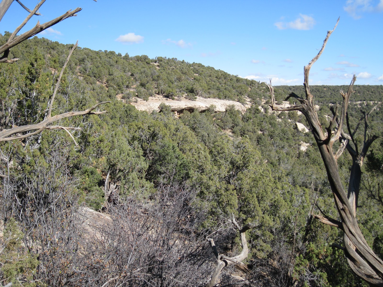
Except for the rubble on top of one of the large boulders, this site would be hard to spot from the distance. The remains are mostly rubble piles and are hidden by the thick forest. It wasn't possible to step back and get a good overall view. To visit the site I had to wind around all the tall boulders and trees, without seeing what was ahead.

On this hike I also looked around the western arm of the canyon head and a little on the mesa top area between the two arms of the canyon head, but without noticing any other ruins sites. A hike to just this ruins site would take about 3:00 hours for about 4 miles With my exploring and scanning and visiting the site my total hike took about 5:30 hours. I carried 2 liters of water on an 65 F degree mid March day.


Wednesday, November 16, 2011

Woods Canyon East Rim Road-North

The Woods Canyon area of Canyons of the Ancients is west of the community of Yellow Jacket in southwest Colorado. From Highway 491, turn west on Road Y and south on Road 15.

About 0.2 miles south of the junction of Roads U and 14, a well maintained gravel road turns west and leads south for 6 miles along the east rim of Woods Canyon, eventually reaching an overlook point of the junction of Sandstone Canyon and Yellowjacket Canyon.

About 1.6 miles along this road, there is an unmaintained side road that runs parallel to the main road on the east side for about 1 mile. I started my hike at the north end of this side road and walked this segment without noticing any Ancestral Pueblo ruins sites.

There are several points where the road is close to the rim and allows some good views to the east. From the south end of the segment I turned east to find the canyon rim again. From this angle there are some alcoves visible in the second level of cliffs.

The alcoves are approachable, without a trail, from the south side. There aren’t very many alcove ruins sites in the Canyons of the Ancients. This is one of the bigger alcove sites that I have seen here.

There are a series of these small structures in the alcoves at the base of these cliffs. Rubble flows away from the alcoves down the slope.


These rooms all seem to be small. I didn’t notice any pottery shards or rock art around this site.

Below the alcoves, there are some large boulders. Often, large boulders form the foundation of ruins sites. In this case, there is a large rubble pile site near the boulders that doesn’t use the boulders as part of the structure.

The amount of stones used for this rubble pile site is probably greater than the entire alcove collection put together. Alcove sites are popular to visit as they are usually better preserved, but the rubble pile sites usually seem to be much larger and are more numerous in the Canyons of the Ancients.

I found a small gap in the cliffs to climb back to the rim, but this spot isn’t obvious and would be a tricky descent. The cliffs extend for a distance to the north, so the south side approach appears to be the easiest. From above, the rubble pile ruins site is visible. I didn’t see any rim top structures above the alcoves.

My total hike took about 2:00 hours for 2 miles on a 48 F degree mid November day. There is a mesa top ruins site along another side road about 1 mile south of this site. Both of these sites are close to the large Wood Canyon Pueblo site.

Friday, May 13, 2011

Woods Canyon East Rim Road-South

A hiking access for Woods Canyon in the Canyons of the Ancients is located in front of a carbon dioxide gas plant at the corner of County Road U and County Road 14. This area is west of the community of Yellow Jacket in southwest Colorado. From Highway 491, turn west on Road Y and south on Road 15.

About 0.2 miles south of Roads U and 14, a well maintained gravel road turns west and leads south for 6 miles along the east rim of Woods Canyon, eventually reaching an overlook point of the junction of Sandstone Canyon and Yellowjacket Canyon.

About 1.1 miles along this road, there is a vague side road near one of the gas wells that leads to a view point of the large Woods Canyon Pueblo Ruins site. I noticed a cow trail leading down into the canyon at this view point, which might provide an easy hiking route to the canyon bottom.

I continued driving for a total of 2.5 miles to another drill site that was on the edge of a hill top just before the road started a downhill segment, and began hiking south along the mesa top through the Pinon and Juniper forest.  The canyon rim area was easy to walk along and there were frequent view points across Woods Canyon.
The mesa top area is narrow and there were also good view points to the east across a side canyon of Yellowjacket Canyon. I did a lot of scanning with binoculars, but only sighted the Woods Canyon Pueblo and the square tower ruin site that I have seen before. My 3 mile round trip hike took 2:20 hours and I returned to my starting point.

Near where I parked, there is a dirt side road, and I hiked over to see if there was a rim view point near this road. I was surprised to come across a large mesa top ruins site only a few minutes down this trail.

This site is overgrown with sagebrush and trees, but seems to be relatively large. Many of the collapsed structures appeared to be circular, some large and some small. 

In a couple of places, some wall sections are still intact. There were several bare earth places where pottery shards were visible.
The location of these sites is usually interesting. Residents here could probably see the Woods Canyon Pueblo site and visit there easily.
 
This large village site is close to steep cliffs that can be viewed by driving a short distance down the road to another side road. These cliffs overlook the side canyon that connects to Yellowjacket Canyon. After hiking, I drove the rest of the gravel road and stopped at several view points. There are good views of Yellowjacket Canyon and lower Sandstone Canyon. (On a later hike I found an alcove ruins site about 1 mile north of the mesa top site.)

Sunday, May 1, 2011

Northwest Woods Canyon Village

The north mesa top area west of Woods Canyon in the Canyons of the Ancients can be visited by traveling west on County Road Y from Highway 491 at Yellow Jacket, Colorado, then south on Road 16 to Road W. At the west end of Road W near a gas facility there is the marked BLM Road 4529.

About 0.7 miles along Road 4529, there is a junction with a closed old road that turns north. On my previous visit to this area I skipped passed this junction and continued on the main trail. This mesa top area is between Woods Canyon on the east and Sandstone Canyon on the west.

After about 10 minutes of hiking along the closed road, there is a small rubble pile ruins site very close to the trail.
This site and area has a good view across a sage brush field toward the Blue Mountains that are near Monticello, Utah.
About 5 minutes of walking further north, there is a very large village ruins site. It is heavily overgrown with sagebrush and trees, but the rubble piles are extensive.

I didn’t see any intact walls here. Looking back, I wondered why there is a gap between the large site and the smaller one.
 
Mixed in among the rubble piles are many bare earth spots with scattered pottery shards. I noticed that even the road leading to the site had many small shards along the way.
 
 This large village is about 50 yards west of the canyon rim overlooking the upper part of the side canyon that is parallel and west of the main Woods Canyon. In the distance, the gas plant that is at the Woods Canyon  Trailhead area is visible. Also, the gas plant that is on the mesa top just west of the somewhat well known Woods Canyon Pueblo is visible.

The old road continues a little further north and ends at an agricultural field. I continued a short distance east on a cow trail to the head of the side canyon and turned around without seeing any other ruins sites. I spent about 1:30 hours on this hike on a chilly and windy late April day.

On the return drive along the north side of Road W, I saw a small herd of Bison. I had passed by here a couple of times before without noticing them.

Sunday, April 17, 2011

Woods Canyon Mesa Top

The Mesa Top area between the Canyons of the Ancients Woods Canyon on the east and Sandstone Canyon on the west can be accessed along County Road W west of the Community of Yellow Jacket in southwest Colorado.

The turn off is west on County Road Y from Highway 491, then south on Road 16 to Road W. At the end of Road W near a gas facility, BLM Road 4529 provides as easy trail. I followed the BLM road as it twisted south and east for about 1.5 miles until it ends with a turnaround circle.

On this hike I wanted to see where this road goes and didn’t detour off even though most of the Ancestral Pueblo ruins sites and the good views are usually found near the canyon rims. At the road end, hiking can continue for another 1.5 miles or so out toward an overlook of the junction of Woods Canyon and Sandstone Canyon.

The mesa top area has some narrow sections where there are views both east and west. The west view is one of the best available views of the middle part of Sandstone Canyon. It looks like there is a trail leading toward the canyon bottom below the view point, but I didn’t see where this trail might connect to the mesa top. I scanned the area below with binoculars and didn’t spot any ruins sites, but they are often obscured by the forest.
 

Further out toward the junction overlook on the Woods Canyon side, I spotted a small rubble pile ruins site just below the rim. It was easy to find a way down for a closer look, but this appeared to be a small site without any walls still intact.
 

On a previous hike south of the Woods Canyon Pueblo site, I sighted a square tower in the cliffs below the neck area of this mesa top. It is in an alcove in the darker rock layer that is near the canyon bottom. I looked all along the rim above this structure but couldn’t see the tower from above. I did see a couple of rock cairns in the vicinity, but these didn’t help me find a view point.
 
The cliffs are very steep here. I looked around for more than an hour but the only view of the tower I could find was to descend all the way to the canyon bottom and slightly up the other side. I came across a trail at the bottom of the canyon, probably a cow trail.
 
Besides the cliffs above the tower, there are also cliffs below and the side approaches seemed steep, so I didn’t get a better view than the one from across the canyon. From below, it looks like there should be a route to view the site closer, but the straight up approach is steep. My approach was toward the south side where it was less steep but the structure goes out of site as you climb.

My total hike took 4:30 hours for about 6 miles on a 56 F degree windy mid April day. I carried and drank 3 liters of water.


Friday, November 5, 2010

Woods Canyon Square Tower

There is an old road that provides an easy descent down into Woods Canyon in the Canyons of the Ancients in southwest Colorado. The access is at the corner of County Roads U and 14, west of the community of Yellowjacket, northwest of Cortez, CO along Highway 491.

There is some parking along the road across from one of the carbon dioxide plants in the area. The south leg of the trail leads to a large Ancestral Pueblo ruins site after about 0:45 minutes of hiking.


I continued on the trail past the Woods Canyon Pueblo for another 0:40 minutes until the route seemed to fizzle out in a thick sagebrush field. In the fall, the creek at the bottom of Woods Canyon had a healthy flow of water. The northwest canyon slope appeared easy to climb at this point, so I decided to walk up hill to get a better view. I didn’t realize it, but the mouth of a side canyon was only a short distance ahead.


At the hill top, I had a good view into the side canyon and noticed a square tower perched on the west side cliffs, below the rim. From the distance, I couldn’t see any other structures nearby. This location made it appear that the tower kept a watch on the side canyon entrance. The area below the tower appeared to be steep and I decided just to view the tower from the distance. I was 1:50 hours into my hike at this view point.
I turned back north along the east rim of this side canyon, expecting to see more ruins sites, but didn’t notice anything. I made my way back to the main Woods Canyon and descended back to the canyon floor trail in the vicinity of the Woods Canyon Pueblo. My total hike took 5:30 hours for seven or eight miles. It was a 60 F early November day and I carried 3 liters of water.


Thursday, July 1, 2010

Woods Canyon Pueblo on the Rim

The south segment of the Woods Canyon Trail arrives at the base of large Ancestral Pueblo ruins site in Woods Canyon in Canyons of the Ancients National Monument in southwest Colorado. This trail starts west of the town of Yellow Jacket on County Road U west of County Road 14 in front of a small industrial facility.

There are many rubble pile ruins on the canyon slope and some intact wall sections in the sheltered area just below the canyon rim. On this hike I was trying to find a route to the rim, above the sheltered area.

From below, there are some structures visible above the rim, but steep cliffs prevent easy access to the mesa top area. I looked to the left or west side of the large site for a route up to the rim. It took me 0:45 minutes to arrive at the base of the site from the trailhead and another 0:30 minutes to find a way to the mesa top ruins area.

There are several large rubble pile structures up above and they are all very close to the rim, with broad views over Woods Canyon and Sleeping Ute Mountain visible in the distance.

There is one good section of wall still standing. This looks like the back wall of a square structure and this is the one that can be spotted easily from below. The old road that acts as the Woods Canyon Trail leading to the site is clearly visible down below.
On the return hike I stayed closer to the edge of the rim and found a shorter route down, than the way I came up, that connects to a trail that visits the several small sites that are just below the rim. From below the rim, this trail winds left around a cliff corner and there are some rocks arranged that have been secured with a T post to aid in the climb up or down. This vague trail leads past the small room block that is on the left or west side of the overall site.

There are a couple of more small structures along the under the rim trail and eventually the trail leads to the larger wall sections that catch most of the attention. From this side of the site, there are some cow trails to look for that make the descent a little easier than from below the larger wall sections.


The approach from the left side also allows a close view the three large boulder based structures that are near the bottom of the canyon slope. My total hike took 4:00 hours for about 5 miles on an early July morning. The temperature at 9:00 AM was about 65 F degrees and it was about 85 F degrees at 1:00 PM when I finished. I carried and drank 3 liters of water.

On this hike I knew where the site was when I started and didn’t spend any time searching, as is often the case. There is a lot to see at this large site.


Tuesday, August 25, 2009

Woods Canyon Pueblo Trail

The south leg of the Woods Canyon Trail leads to the large Woods Canyon Pueblo in Canyons of the Ancients National Monument in southwest Colorado.

 The trail head is on County Road U west of County Road 15 across the road from one of the Carbon Dioxide gas plants. This area is near the town of Yellow Jacket, CO and west of Highway 491.

The trail follows an old road down into a side canyon and then into the main Woods Canyon to a junction that allows travel north and south. For this hike I turned south toward and then under the major power lines that cross the canyon a short distance to the south. From the trail junction there is also a large Ancestral Pueblo ruins site about 1 mile to the north.

A few hundred yards past the power lines some cliffs become visible on the west side. With binoculars, some wall sections of a ruins site are visible just below the canyon rim. There is a creek with flowing water between the trail and the ruins site. Parts of the creek bottom are very thick with vegetation.

I continued on the trail a little south of the ruins site until I found an area where the vegetation thinned out and the creek could be easily crossed. I didn’t see a trail going up to the ruins site. A short distance up the canyon side, rubble pile ruins structures start to appear and there are many of them.

The climb up to the standing wall sections is steep and a little treacherous. From below, some wall sections on the canyon rim are visible but I couldn’t see them from the ledge just below the rim. I didn’t see any easy way to get onto the rim from the ledge. (On a later hike I found a route that connects to the trail along the ledge under the rim.)

Besides the most obvious below the rim wall sections, there are others visible along the rim to the south and maybe some storage sites to the north.
From the elevated position there are views up and down Woods Canyon. Several of the large boulders to the south show rubble remains on top and there are many rubble mounds down the canyon side hidden by the Pinon Pine and Juniper forest.

The Woods Canyon Creek appears to have year round water and some of the pools support cattails and bulrush. I saw at least one large cottonwood tree in the canyon bottom. There are also fields of sagebrush visible, indicating good soils for farming. Woods Canyon appears to be a relatively lush location that could have supported large villages.


I returned after visiting this site, but the trail appears to continue further south. My return hike to the trail head from the ruins just below the rim took about 1:00 hour for a distance of about 2 miles.

I spent 4:00 hours total on this hike but much of it was spent exploring the side canyon west of the trail junction. That side canyon looked promising but I didn’t find anything but good views. I carried 2 liters of water on a 70 degree F partly cloudy day in late August.