Showing posts with label Anasazi Heritage Center. Show all posts

Friday, December 28, 2012

Turkeys of the Ancients


One of the minor displays at the Anasazi Heritage Center in Dolores, Colorado discusses the importance of turkeys to the Ancestral Pueblo people that lived in the Four Corners region.

Turkeys, along with dogs, were the only domesticated animals kept. It is thought that domestication began around 800 AD, though wild turkeys had been captured and used before. Turkeys were important as a source of food, feathers, and a source of bone tools.


The wild turkey that currently lives in the region is called Merriam’s Wild Turkey and is a sub species of the well known Wild Turkey. Male turkeys can reach a length of 48 inches and weigh 18 pounds. The typical habitat is the Ponderosa Pine forests that are mixed with Aspens down to the Gambel Oak forest that blends into the Pinon Pine and Junipers.

They naturally eat pine nuts, acorns, green vegetation, and insects, particularly grasshoppers in summer. The interpretive information at the parks often says that the Ancestral Puebloans fed the turkeys with corn until they started to run out of corn and then the turkey remains disappeared from the trash mounds.


The drawer display has several examples of bone tools made from the turkey skeleton.


Turkeys appear occasionally in the rock art of the region. This Barrier style image was part of the Sacred Images exhibit at the Anasazi Heritage Center in 2011. The text with this picture only says it is from the western Colorado River drainage. It isn't one of the images on the Horseshoe Canyon Trail in Canyonlands.


There are turkey track petroglyphs in the Canyons of the Ancients. This image is near the Big Spring Pueblo and Hovenweep Canyon.


Turkey track images appear also on pottery.


The turkey feathers were used to make robes, blankets and socks. There is a replica of a turkey feather robe at the Anasazi Heritage Center.


The feathers were split down the middle and wrapped around yucca cords. By 1100 AD feather wrapping was more common than fur, perhaps because the materials were easier to obtain.


On Wetherill Mesa at Mesa Verde, the Two Raven House on the Badger House Trail features evidence for a fence that partially encloses the plaza. One of the possible explanations for the fence was to keep turkeys in or out of the village. One of the ruins sites along the Kane Gulch Trail in Grand Gulch, Utah is known as the Turkey Pen Ruin.

18407_$5 Shipping on Orders of $99 or More! 544544_Travelation: More flights. Lowest price, guaranteed with no booking fees

Wednesday, December 5, 2012

Ancient Skywatchers Exhibit at the Anasazi Heritage Center

Beginning November 23, 2012 and extending to April 2013, the Anasazi Heritage Center in Dolores, Colorado is hosting the Ancient Skywatchers of the Southwest Exhibit.

Images by photographer John Ninnemann show how the Ancestral Pueblo people that lived in the Four Corners area prior to the arrival of European American settlers had an advanced understanding of the paths of the sun and moon. This knowledge was important in the timing of crop planting and ceremonial events.


Along the first wall when entering the exhibit there are displays on the moon and the sun and images from Mesa Verde National Park. The Mesa Verde images emphasize a particular view point marked by a small pecked basin that is south of the famous Cliff Palace. From this pecked basin the sun sets directly over the Sun Temple on the Winter Solstice. I don’t think the pecked basin is pointed out on the normal Cliff Palace tours, or maybe it off the trail and not visible.

The Sun Temple is easy to visit site on the self guiding Mesa Top Tour at Mesa Verde. The trail guide points out that there is a natural rock basin in the southwestern corner that Jesse Walter Fewkes speculated was a solar marker. No evidence of roof material was found at the Sun Temple, leading the conclusion that the structure was unfinished.


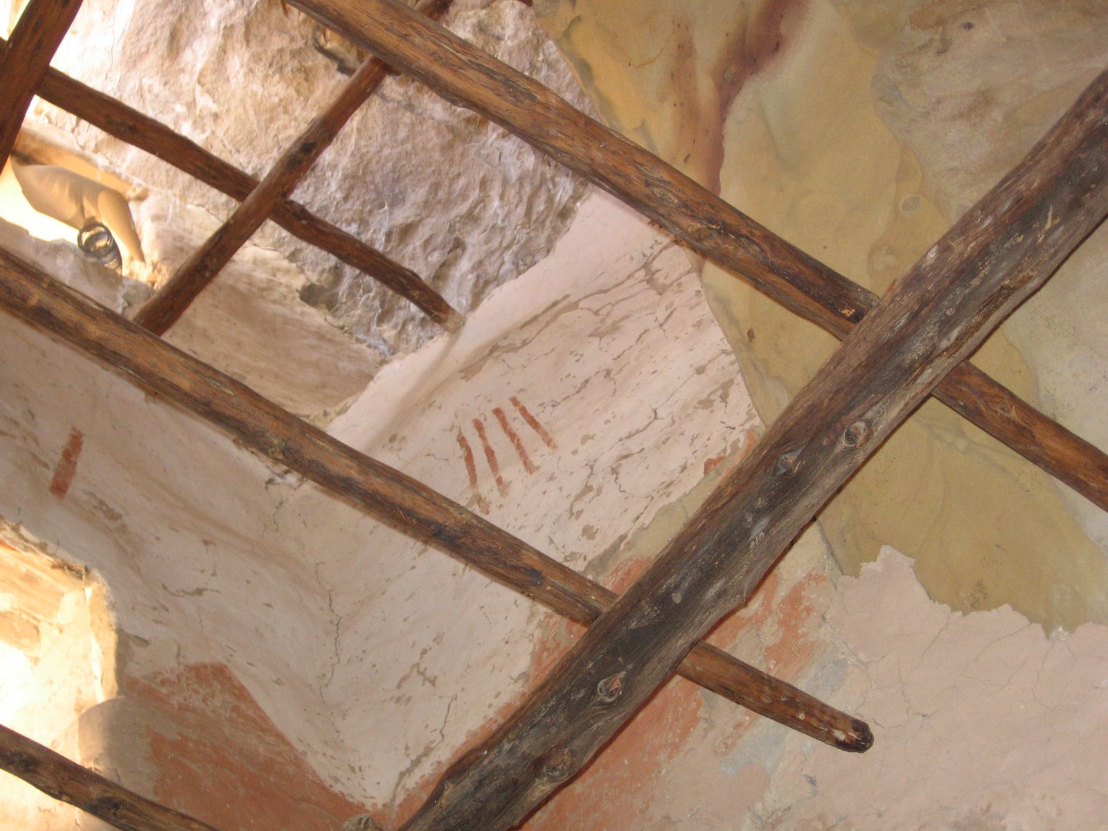
A four story tower on the south end of the Cliff Palace alcove has some artwork visible on the interior. If you aren't in a hurry at the end of the tour, you can usually wait in line to lean into a small doorway and look up.

The older trail guides for Cliff Palace describe these images as decorative but the Skywatchers Exhibit suggests that these may represent a record of observations of the moon. The exhibit has a close up picture of the artwork that gives a better view than a visitor can see on the tour.

The guided tours of Cliff Palace are usually offered from April to November. In the winter season, there are good view points from the Sun Temple and the Cliff Palace trailhead.


The second long wall has displays of Hovenweep National Monument and Yucca House National Monument. The Holly Ruins Group is one of the outlying Hovenweep sites and is located about 4 miles north of the Hovenweep Visitor Center. At the south end of the Holly Group there is an overlook of a petroglyph panel that is thought to mark the summer solstice.

On the summer solstice there is a dagger of sunlight that crosses a set of concentric circles. The exhibit has a good close up picture of the sun dagger crossing the concentric circles. The Holly Group is somewhat remote but is easy to visit.


Yucca House National Monument is a large unexcavated ruins site located south of Cortez, CO between Mesa Verde and Sleeping Ute Mountain. The sun at winter solstice appears to set on top of the toe of the Sleeping Ute when viewed from the upper Great House. The Yucca House site is easy to visit but doesn't get much publicity.


Pictures of Chaco Canyon in northwest New Mexico take up the third wall of the exhibit. Chaco Canyon has many examples of knowledge of the heavens. On the Penasco Blanco Trail there are pictographs that are thought to depict the Supernova of 1054 AD. There are several nearly exact north and south alignments at Pueblo Bonito and Casa Rinconda.


Fajada Butte is probably the most prominent archaeoastronomy site in the Chaco Canyon Park. Visitors can only view it from the distance but interpretive signs point out that there are three boulder slabs directing sunlight onto petroglyphs that mark the solstices and equinoxes. There are good elevated views of Fajada Butte from the Chaco Canyon Overlook Trail at the Gallo Campground.


The Anasazi Heritage Center has more information than is obvious at first glance. In the main gallery there is a table with four computers. One of the computers focuses on Chaco Canyon and the greater Chaco community. Part of the computer display discusses the Fajada Butte solar site and includes more Skywatcher pictures and discussion.


The fourth outer wall of the Exhibit features Skywatcher sites from the Cedar Mesa and Comb Ridge area of southeast Utah. The set of four images shows the sun rising close to the summer solstice along the cliffs north of the San Juan River. Other images show some of the many alcove sites in the Cedar Mesa area. The Cedar Mesa area has many interesting trails but they are mostly unpublicized.


The center of the exhibit floor features Chimney Rock, the Yellow Jacket Pueblo, and the V-Bar Ranch. Chimney Rock between Bayfield and Pagosa Springs, CO has been elevated to National Monument Status in 2012. There are two short trails at Chimney Rock with the Great House Pueblo Trail appearing to be closely associated with the Lunar Standstill. The largest north and south difference between where the moon rises during its monthly cycle occurs on a regular 18.61 year cycle that is known as the Lunar Standstill.


There is a large Great House ruins site with a good view of the Chimney Rocks. This is an unusual high elevation location for a large structure and there doesn't seem to be any reason for it to be here except for these Skywatcher observations. This is an easy site to visit.


Yellow Jacket Pueblo is the largest known ruins site in the Mesa Verde region. Tours of the Yellow Jacket Pueblo are offered usually three times per year during the summer months. The tours are publicized and arranged at the Anasazi Heritage Center.

One of the interesting features of the tour is the solar monument that appears to line up with the Lizard Head formation in the San Miguel Mountains that are near Telluride.


The V-Bar V Ranch is near Sedona, Arizona has a petroglyph site with 1032 glyphs on 13 panels. It is believed that part of the petroglyph site is a solar calendar that would have aided the agricultural activity in the area.


Not included in the exhibit, but part of greater Mesa Verde is the Mancos Canyon area of Ute Mountain Tribal Park. There is a special Sun Calendar Tour, usually offered in late May that visits several monuments and petroglyph panels that are also thought to be related to the Ancient Skywatchers.


Saturday, June 30, 2012

Escalante Pueblo Overlooks and the Weber Canyon Fire


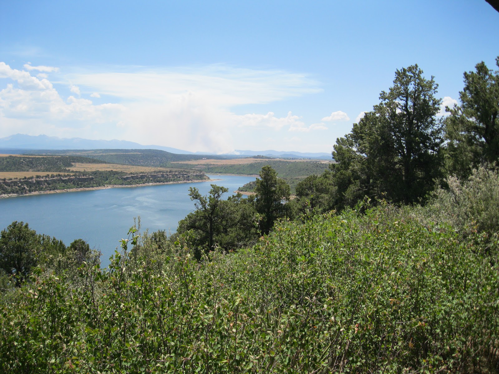
On June 30, 2012 at 12:00 noon, smoke from the Weber Canyon forest fire is visible from the Escalante Pueblo overlook points at the Anasazi Heritage Center near Dolores in southwest Colorado. One of the interpretive signs on the hilltop at the end of the 1 mile round trip hike has these comments about the surrounding landscape.


From this hilltop one can view the six directions significant to Native Americans – north, south, east west, zenith (above) and nadir (below). It is a place to watch the sun during its yearly journey along the horizon, a place to gaze at stars in the night sky, a place to observe and appreciate the diversity of the landscape that surrounds you.


They understood that humans are not distinct, separate beings from the natural environment but that every act and thought of any human being affects the cosmos. They moved through the land with a sensibility that allowed nuances of the wind, sun and ground to affect their decision making…Their sense of home, or place, was in the space between the earth and sky and not with a specific human-built structure.

Sunday, June 10, 2012

Anasazi Heritage Center June Flowers


Summer visitors to the Anasazi Heritage Center near Dolores, Colorado will notice the colorful display of flower beds near the entrance. There is a co-operative program called Plant Select that has developed this Demonstration Garden using native Four Corners plants and selected others. The Anasazi Heritage Center is the Visitor Center for the Canyons of the Ancients National Monument.


These plants are well adapted to this zone that is between the Pinon and Juniper forest and the Ponderosa and Gambel Oak forest. There is a free guide to all these plants inside the Heritage Center. I visited on June 9, just as some of the plants were coming into spectacular bloom. The Chuska Puma, one of the Pumas on Parade, has a good position on the left side of the entrance plaza.


Shrubby Cinquefoil in the Rose Family has colorful yellow blossoms and is found along trails in the Four Corners. Behind are red and yellow Blanket Flowers. The guide mentions the uses that early residents had for many of these plants.

The combination of the blue and white Rocky Mountain Columbine with the Denver Gold Columbine is spectacular in early June. There is also a Red Columbine that occurs along trails and is here at the garden, though I don’t think I saw it on this visit. Columbines are in the Buttercup Family.


Some of the plants, like these Wine Cups, have Plant Select labels. For some it is harder to find the labels and the plant guide is helpful for those. The plant guide has common names and genus names but doesn't seem to include plant families.


The Desert Four O’clock or Miribilis is one of my favorites to find along the trails. 


Apache Plume in the Rose Family has feathery plumes that carry the seeds. It probably had many white flowers that have already faded. Behind it I think is the ornamental Green Ash. I could see the small canoe paddle shaped seeds getting ready to flutter down.


There are many more to find and the plants in bloom will change through the growing season.


Toward the end of June the Coneflowers come into bloom.  Purple Coneflowers and ...


Prairie ConeflowersIn addition to the plant beds near the entrance, the whole site, even the parking area can be considered as a botany resource.


At the end of July, Bee Balms are replacing the columbines in front of the Chuska Puma. The one mile round trip interpretive trail to the Escalante Pueblo site also has identification for some the native plants.


Monday, April 23, 2012

Stone Tools on the Trails

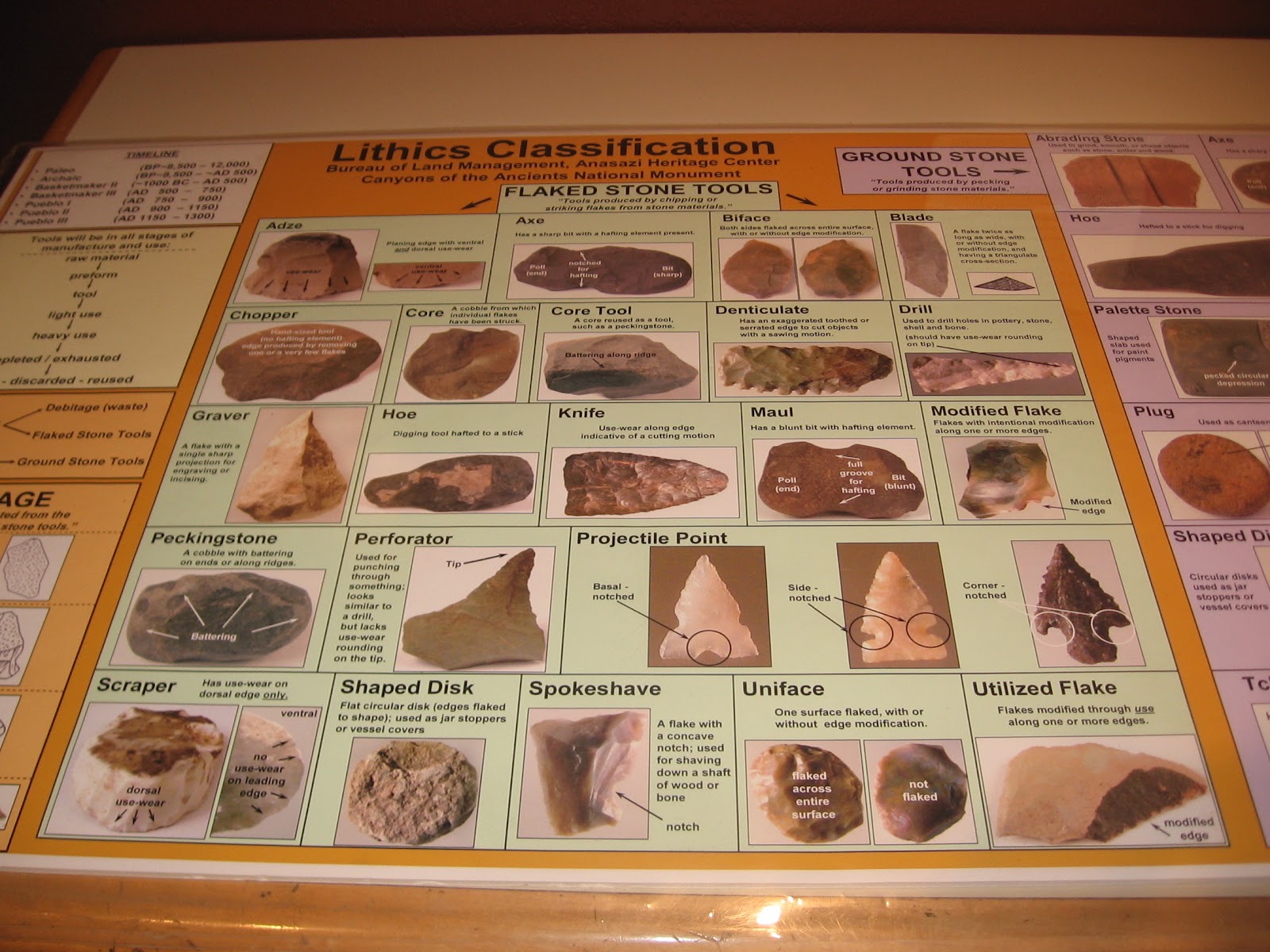
Hikes to the seldom visited Ancestral Pueblo ruins sites in the Canyons of the Ancients reveal pottery shards and small stones that could be tools. The Anasazi Heritage Center near Dolores, Colorado has interpretive displays to help understand these artifacts. While picking up and observing these objects in usually encouraged, they should be left where they are found.


The Heritage Center display has 22 different types of lithics classifications, and this doesn’t include the large category of grinding stones. The stone pieces that I see are mostly not recognizable as a distinct shape, such as a projectile point, but many seem to have sharp edges or sharp points. 


Occasionally there are small hiker made arrays of stones near a ruins site. Glancing at them, it is obvious that there are several different minerals available.


None of these shapes are very distinct, but among the classifications are blades, gravers and perforators. 


In a drawer below the lithics classification poster, there are examples of the minerals that are available in the Canyons of the Ancients, both in a raw and finished form. The minerals on display include grayish Morrison Orthoquartzite, silvery Chalcedony, streaky Silicified Sediment and streaky Chert/Silicified Sediment, grayish Brushy Basin Chert, the reddish Jasper, and grayish Burro Canyon Orthoquartzite.


Chalcedony is described as a mix of quartz and moganite, two different crystal forms of silica dioxide. Chert seems to be a more general term for rocks that are quartz crystals but doesn’t include quartzite. Quartzite is a metamorphic rock that was originally sandstone and was altered due to pressure and heat. Orthoquartzite is very pure quartz sandstone. Jasper seems to be an impure form of Chalcedony and can occur in various colors due mostly to Iron.


The Burro Canyon Formation and the Brushy Basin Member of the Morrison Formation are just below the Dakota Sandstone that forms the cliffs at the top of many of the Canyons of the Ancients. The trail guide for the Sand Canyon Trail has a diagram of these formations and they are exposed along the northern segment of the trail.


Another concept to consider when viewing these objects is Debitage, or waste flakes that are produced in making a useful tool.  One of the categories of waste flakes is called angular debris, a piece that breaks off while flaking by accident.


544544_Travelation: More flights. Lowest price, guaranteed with no booking fees

Tuesday, April 26, 2011

Sacred Images Rock Art Exhibit

The Anasazi Heritage Center in Dolores, Colorado is hosting the Sacred Images Rock Art Exhibit from April to October 2011. Photographs of four styles of Utah Rock art are on display that may span 8000 years. The Anasazi Heritage Center acts as the Visitor Center for the Canyons of the Ancients.

The Chuska Puma greets visitors to the Anasazi Heritage Center. The Chuska Puma is part of the Pumas on Parade effort to raise awareness of mountain lions. This puma has some examples of rock art as part of its design. There are 17 or so artistic pumas on display, mostly in southwest Colorado.

The Chuska Puma was donated by the Kinder Morgan Company, who also provides road maintenance in the remote parts of the Canyons of the Ancients. My own experience is that the gas well workers have been helpful to hikers trying to find their way around the backcountry areas. The puma has been recently moved from inside the Center to this attractive outdoor position

The most ancient art is called the Barrier Canyon Style. The artists are currently called the Western Archaic Native Americans, but we are not sure who they were or even who their descendants are. They lived as hunters and gathers and left their paintings in sheltered canyons along their migration routes. The most famous place to find examples is in the Grand Gallery of Canyonlands National Park. They have many very large ghostly and spirit figures.

 The group that we used to call the Anasazi, and now call the Ancestral Pueblos were the first group to practice agriculture in Utah. The Ancestral Pueblos rock art is divided into the Basketmaker and Pueblo phases. The rock art resembles the Barrier Canyon and Fremont style but the images include arms and hands and more details.

There are some relatively easy panels to find along the San Juan River near Bluff, Utah, particularly the Sand Island boat launch site. The small panels that are visible at Mesa Verde are some Colorado examples. The Pueblo phase people produced less rock art, but more decorated pottery, weaving, and kiva painting.

The Ute Style is the most recent, dated from 1600 to 1930. The Ute Style features horses, bison, and shield-shaped stick figures. The Ute Mountain Tribal Park near Cortez, CO has some Ute local examples, and horse figures are found in a few places in the Canyons of the Ancients.

In the gallery room, the pictures are arranged around the outer wall, with a center section. Each picture has a short description, and there are interpretive posters giving general information on each style. I was hoping for maps that would show where the sites are located, but no luck.
 
The group that we call the Fremonts lived in the northern three quarters of Utah from 400 to 1300 AD. We don’t know who their ancestors or their descendants are. There are several styles of Fremont work, with many animals, hunting scenes and horned human figures.

There is a book of these same pictures on sale in the gift shop. I would like these books to include maps or directions that show how to visit these sites yourself, but they usually don’t.


Friday, January 7, 2011

Escalante Pueblo Hilltop Winter Views

The Escalante Pueblo is one of the few excavated and easy to view sites in the Canyons of the Ancients National Monument in southwest Colorado. The site is located on the hilltop at the end of the 0.5 mile Interpretive Trail behind the Anasazi Heritage Center near Dolores, CO. In winter, the trail is cleared of snow and can be easily hiked.

Escalante Pueblo and its nearby neighbor Dominguez Pueblo were built in the 1120s by the Ancestral Pueblo people. The location is remarkable for the views over the Dolores River with the San Juan Mountains visible in the distance. It has a rectangular layout surrounding a circular kiva. The building style resembles the Far View House at Mesa Verde and the Lowry Pueblo near Pleasant View, CO.


The Escalante Pueblo overlooks the area called the Big Bend of the Dolores River. The Dolores flows south from its headwaters near Lizard Head Pass and makes a sweeping turn to the northwest, flowing toward a junction with the San Miguel River and on to a junction with the Colorado River upstream of Moab, Utah. The area that is now flooded by McPhee Reservoir is rich with now submerged archaeology sites.
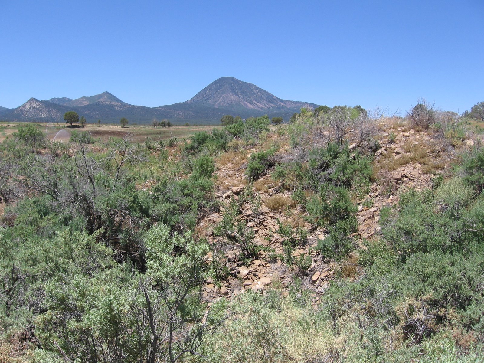
The view to the east is dominated by the LaPlata Mountains, featuring Mt. Hesperus, one of the four sacred peaks of the Navajo. The grassy mesa top areas on the north side of the McPhee Reservoir have some small ruins sites that can be visited by hiking. The Anasazi Heritage Center acts as the visitor center for the Canyons of the Ancients and has excellent and creative displays of the artifacts that were recovered prior to the construction of McPhee Reservoir.


Getting to Know Canyons of the Ancient National Monument