Showing posts with label Cannonball Mesa Cliffs. Show all posts

Sunday, September 25, 2011

Cannonball Mesa Cliffs Southwest

The southwest corner of Cannonball Mesa has a rocky point above high cliffs that overlooks the Ismay Pueblo and Petroglyph site. This area is on the southwest side of the Canyons of the Ancients area in southwest Colorado. The access is about 26 miles west of Cortez, CO along County Road G. A short distance east of the point, there is a south turnoff that leads to the Hamilton Mesa area.

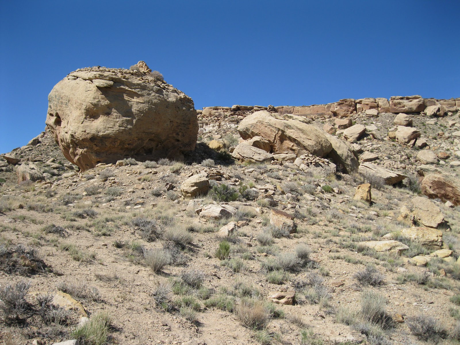
On the north side of County Road G, across from the turnoff, there is a short unmarked trail that climbs toward the south side cliffs. On a shelf area below the cliffs, the Ismay ruins site has a boulder based neighbor. This site is visible from the mesa top point, but isn’t visible from the road.

The boulder forms something of a rock shelter with a constructed room in front. There are remains of other rooms around the west side also.

From the backside there views of the wall segments on top of the boulder. The overall site is bigger than it appears at first. More rubble is behind the boulder and there are minor structures spread across the hillside. This terrain and environment here appears to be very dry but it is near the junction of McElmo Creek and Yellowjacket Creek, both with flowing water most of the year. The Cannonball Mesa area has several more ruins sites to search for.

On the east side of the boulder there is a petroglyph panel. I haven’t seen much rock art in the Canyons of the Ancients except here in the Cannonball Mesa area.

Some of the other nearby boulders have minor images also. There is a roadside boulder a short distance west of the trailhead that has easy to view rock art, but it is somewhat vandalized with recent graffiti. Some of the rock faces up above have initials inscriptions with dates from the 1930s.

I spent 1:20 hours visiting this site on an 82 F degree late September afternoon. The hiking distance is very short; most time is spent exploring the area. The Ismay Pueblo and Petroglyph site is just a short distance further west. It is probably possible to continue to the mesa top from this site. From the mesa top view I saw a notch in the cliffs above the ruins that can be hiked, but I thought it would be easier to visit from the road.


532497_120 x 90 Starting Salary $42k. Group 1 18407_$5 Shipping on Orders of $99 or More!

Sunday, March 20, 2011

Cannonball Cliffs to Yellow Jacket Creek

The north cliffs of Cannonball Mesa overlook the lower section of Yellowjacket Canyon in the southwest part of the Canyons of the Ancients National Monument in southwest Colorado. The west end of Cannonball Mesa is 26 miles west of Cortez, CO on County Road G to the rough Yellowjacket Canyon Road at Ismay Trading Post.


The unmarked cow trail that provides an easy route to the top of Cannonball is 1.4 miles north along the rough road. At the top I turned left or north, and continued along the rim, past a narrow northwest point to an overlook of a boulder based Ancestral Pueblo ruins site. Slightly to the east, there is a notch in the cliffs that allows a descent down the slope.

I had spotted this site on a previous hike along the Cannonball Mesa Cliffs. The notch has several easy to view petroglyphs near the rim. It took me 0:45 minutes to arrive at the notch.
 

The hike down the slope is somewhat slippery but feasible. The best routes are often easier to see looking up the slope rather than down. At the ruins site, there are some minor wall sections still in place around the edges on top and much rubble has tumbled down on the south side.


 I didn’t see any other structures around the boulder. From this site it is an easy walk down toward the canyon bottom and the flowing creek and there are many other large boulders in the vicinity.

One of the large boulders about 100 yards to the west has a clearly visible horse image sitting above a faint but larger horse. This panel faces the canyon bottom area.

At the canyon bottom there is a continuation of the Yellowjacket Canyon road, but direct access is blocked by private property. This section of the canyon bottom is part of the Canyons of the Ancients for about 1 mile. Many other segments of Yellowjacket Canyon bottom are private property.

I followed the old road, walking slowly and scanning the opposite side with binoculars. In about 20 minutes of direct walking, the road leads to the creek and dead ends. I didn’t spot any ruins sites in the creek area, but they are often hard to see from a distance. During my hike, there was an old backhoe parked at the end of the road.


I was 3:10 hours into my hike when I arrived back at the ruins site on my return hike. I saw a few alcoves high to the west and wanted to see if there was another route to this area. When I climbed to a ridge below the alcoves I had a major surprise. (Go to the next post for the surprise.) Otherwise, my total hike took 4:10 hours on a 60 F degree partly cloudy and windy mid March day. I carried and drank 2 liters of water for about 5 miles of hiking.


Hovenweep and Yellowjacket Junction

The northwest corner of Cannonball Mesa overlooks the junction of Yellowjacket and Hovenweep Canyons in the Canyons of the Ancients National Monument, near Ismay Trading Post in southwest Colorado.

After visiting a small ruins site along the north Cannonball Cliffs rim hiking route I looked for an alternate route back to the mesa top.


I was so stunned when I came over a small ridge that I gasped aloud. Besides being surprised by this ruins, this site has an impressive location that sits with a perfect view down Yellowjacket Canyon and up Hovenweep Canyon.

 There are many boulder based ruins sites in the Canyons of the Ancients, but this one seems to be perched on a perfect cube and has several clearly visible rooms.

I saw one large petroglyph image on the boulder foundation and a small spiral. I could see the Yellowjacket Canyon road and my parked car from this site. It is visible with binoculars from down below, but is hidden when hiking along the rim. I didn’t find an easier return route than the way I came.


Sunday, March 6, 2011

Cannonball Mesa Point

Cannonball Mesa Point overlooks the Ismay Pueblo and Petroglyph site along the southwest side of the Canyons of the Ancients area in southwest Colorado. This area is about 26 miles west of Cortez, CO along County Road G, then about 0.2 miles north on the rough Yellowjacket Canyon road.

I started my hike 1.4 miles northeast along the rough Yellowjacket Canyon road and followed a cow trail to the top of the mesa. The cow trail isn’t marked but is reasonably obvious and the climbing is easy. It took me 20 minutes to get to the rim where I turned right, back southwest toward the point. At the top, I startled a group of cows that were lounging there. I followed the rim along the cliffs overlooking the mouth of Yellowjacket Canyon.

Near the point there is a new looking protective barbed wire fence and a short distance beyond there is an ancient zig zag rock wall that encloses the point, about 300 yards from the tip. It took me 0:45 minutes of hiking to arrive at the rock wall.

On the south end there is a circular structure tied into the wall. Also at the south end there are views over McElmo Canyon and County Road G. This is one of the better view points that can be found in the region.

Between the rock wall and the point, particularly on the north side, there are several rectangular outlines made of flat slab rocks turned vertically. Mesa Verde National Park has some excavated and interpreted sites similar to these on the Mesa Top self guiding tour and also on the Badger House Trail. The information there says that the transition from pit houses to pueblo villages featured shallow slab lined pits supporting a frame and lattice of wooden poles that were plastered over with mud.

In later eras, the wooden structures were replaced with stone masonry. The Mesa Verde Interpretation suggests that there may have been a shortage of wood, or that disastrous fires prompted the change. The date of this style is given as 850 AD. I also noticed a large circular depression that was outlined with similar rocks.

There is also a Mesa Verde interpretive sign describing small stone lined food storage structures, maybe like this.

The rocky tip of the point has quite a few potholes in the sandstone that catch and hold quite a bit of water. There is water available for this site in the canyon bottoms below from the flowing creeks, but none near the mesa top point other than these natural storage tanks.

The mesa top area is dry rocky terrain with a few Juniper trees and desert shrubs and grasses. From this water storage area, there are also views overlooking the pueblo site that is near the Ismay Trading Post.
 
Looking south near the south end of the zig zag wall, there is a boulder perched structure between the cliffs and County Road G. I only viewed this structure from the rim. I lingered on the point for 1:15 hours and the return hike took 0:50 minutes for a total hike of 2:50 hours for about 3 miles. I carried and drank 2 liters of water on a 52 F degree early March day.
Friday, March 4, 2011

Cannonball Mesa Cliffs

The west end of Cannonball Mesa has impressive cliffs that overlook the rough Yellowjacket Canyon road at the junction of Yellowjacket and McElmo Canyons. This area is on the southwest side of the Canyons of the Ancients National Monument in southwest Colorado. Follow County Road G about 26 miles west of Cortez, CO to the Ismay Trading Post and turn north.


I started my hike about 0.25 miles northeast on the rough dirt road below the Ismay Petroglyph and Pueblo site that is based on a large boulder. I hiked along the road for about 1 more mile until I found a cow trail that leads to the rim in an area where the cliffs are not so impossible looking. From where I started, it took me about 0:25 minutes to find the trail and another 0:25 minutes to get to the rim. The road is rough but it is possible to drive to the cow trail.
 

At the canyon rim I turned left and followed the rim northeast for about 1 mile. There is a narrow finger of a point and then the rim turns east. In the east segment near the point, I spotted a boulder based ruins site well below the rim. I didn’t climb down to view it closer, but did look closer at the petroglyphs that were close to the rim. I was 1:10 hours into my hike when I stopped to view these images.

Another 30 minutes of hiking brought me to the neck that separates the east and west portions of Cannonball Mesa. The large Cannonball Mesa Pueblo site is on the east side of the neck, approximately 2 more miles of hiking. I turned around at the neck overlook point.

The Cannonball Mesa top is relatively dry compared to the mesas to the north. Juniper trees are few and scattered, with other plants including Mormon Tea, Cliff Rose, Narrowleaf Yucca, Prickly Pear Cactus, and desert grasses. I saw a few cows grazing up here and it looks like most visitors arrive on horseback.

Parts of the floor of Yellowjacket Canyon are privately owned, but in this east and west section there appears to be a 1 mile stretch of canyon bottom that is part of the Canyons of the Ancients. There is a faint road below, but I didn’t see any other development. The area visible here has a broad flat bottom and the creek has flowing water most of the year and there is good riparian habitat. I scanned the area with binoculars and didn’t spot any other ruins sites but they are not always visible from a distance.

The return hike took 1:30 hours out of a total hike of 3:10 hours for about 6 miles. My hike was on a 58 F degree early March day and carried and drank 2 liters of water.