Showing posts with label McLean Basin. Show all posts

Tuesday, September 6, 2011

Pedro Point South

The Pedro Point road leads to one of the easiest to find unpublicized Ancestral Pueblo ruins sites in the Canyons of the Ancients National Monument in southwest Colorado. The route follows the BLM dirt road marked 4720 west.

This road is a west turn, about 1.4 miles south of the turnoff for the Painted Hand Pueblo along paved County Road 10, and about 8 miles north of the Visitor Center for Hovenweep National Monument.
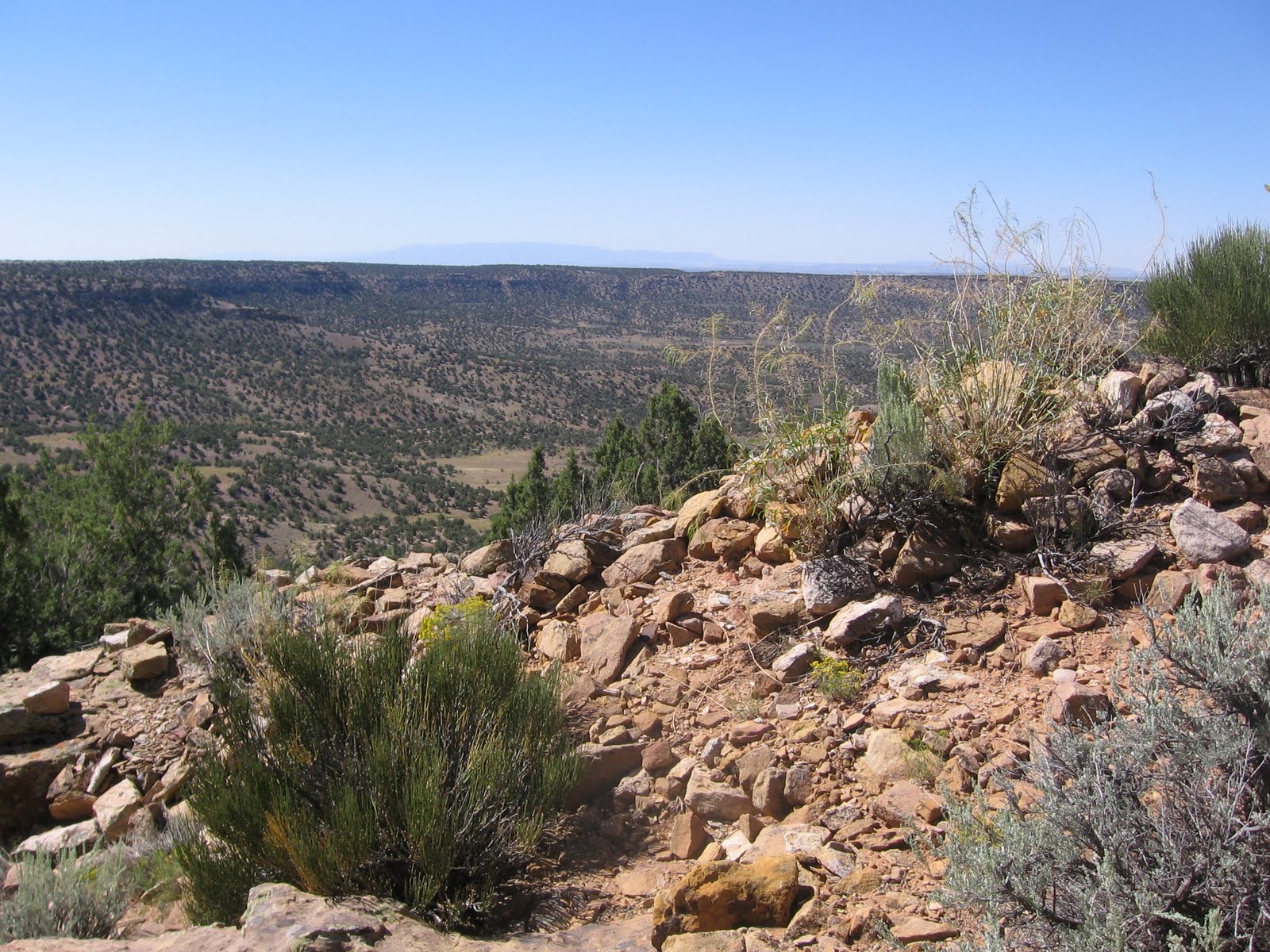
On this hike I was looking in the area south of the Pedro Point Road about half way to the well known ruins site. I drove the first 0.6 miles to the point where there is a good overlook to the north into the McLean Basin, then starting hiking along the road, but mostly looking at the heads of the large side canyon on the south side of the road.

After about 25 minutes and 0.8 miles, I turned south and followed along the west rim of the long side canyon.

After less than 0:10 minutes of hiking, I noticed a tall rubble pile within about 100 feet of the canyon rim. There is a second smaller rubble pile on the west side.

There isn’t much definition to the rubble pile combination. These two structures seem to be isolated, about 1.5 miles southeast of the large Pedro Point site.

There were many pottery shards associated with this site. I mostly saw plain white pieces and corrugated with a few painted designs.

I continued west through a wide sage brush field without seeing any other sites, then turned north and intersected the Pedro Point Road about 0.8 miles east of the large Pedro Point site. Near where I found the road there is a small rubble pile close to the south side of the road. This site would probably not be noticed if you are driving but hikers should see it.

The return hike to my starting point took 0:40 minutes for about 1.6 miles. My total hike took 1:45 hours for about 4 miles. It was an 80 F degree early September morning. I carried and drank 2 liters of water.

There are viewpoints along the Pedro Point Road into the wide McLean Basin. The elusive McLean Basin Towers are visible with binoculars below some cliffs toward the northeast side of the basin.


Tuesday, September 7, 2010

McLean Basin North Rim

There is an access to the north rim of McLean Basin along the dirt road trail that turns west from County Road 10 1.1 miles north of the east turn to the Painted Hand Pueblo Trail in Canyons of the Ancients National Monument in southwest Colorado. The McLean Basin is a large feature just west of the outlying sites of Hovenweep National Monument.


The turnoff is also about 0.4 miles south of the Canyons of the Ancients sign if traveling from the north. On a previous hike, I walked the 1 mile distance to the east rim of a short side canyon that has a boulder based Ancestral Pueblo Ruins site just below the west rim. 

For this hike I drove close to the to the rim and began hiking there, crossing and passing by the same site. (In 2012 this road may be closed to vehicles. It might be tricky to find a place to park along the main Road 10 if this road is closed. Use labels to find McLean Basin Northeast for more pictures of the first part of this hike.)


On the previous hike, I had spotted a rubble pile about 1.5 miles further west on the north rim, but didn’t make it that far. I also saw a second boulder based ruins site on the opposite side of the point from the first site, but it was below steep cliffs and not easy to visit from where I was able to view it.

After reaching the mesa top, I hiked northwest around the next side canyon, then southwest until I reached the rubble pile, perched on the rim overlooking the wide McLean Basin.


It took me 1:30 hours to arrive at the rim rubble pile. Descending just below the rim, the rubble pile spills over the side down onto the lower level.


Looking over to the left, there is a wall of large stones, with more large stones on top of a boulder. There were a number of corrugated pottery shards in view at this site. From this site I hiked further west along the rim for 0:35 minutes until I arrived at the road that ascends from McLean Basin. At the road, a hiker could turn right and explore further north along the east edge of Cross Canyon or turn left and descend easily into the basin.

I chose to turn left and descend and pass by the elusive McLean Basin Towers. I had hiked to the towers previously, starting on the basin south rim on the Pedro Point Road and crossing the basin. I was 3:00 hours into my hike when I arrived at the twin towers.


From the towers, I hiked northeast, across the bottom toward the side canyon where I started. This route makes the hike more of a loop, and allows an approach to the boulder based site that I had previously viewed from the rim. There are two old stock ponds on the basin floor, with a cow trail between them that provides a trail for part of the distance. It took me 1:10 hours to get from the towers to the boulder site.


This site is very rocky and appears to be centered on two structures perched on side by side large boulders. A lot of rubble has spilled off the boulders and is piled up around the base. There is a small rock art panel at this site, but it didn’t look aged and weathered like they usually do. One of the figures looked like a turkey foot.


There are some wall structures built with large stones, similar to the site that is on the rim. That site is in view as I hiked to this one, above and slightly to the west. From here, I hiked east around the point, and back up the side canyon where I started. There is something of a ledge midway up the slope that is easier hiking than the canyon bottom.

This last leg took 1:30 hours, longer than I thought it would. My total hike was 5:45 hours for about 6 miles on a 75 F degree early September day. I carried 3 liters of water.


Friday, May 21, 2010

McLean Basin Northeast Trail

The northeast corner of McLean Basin can be hiked to along the dirt road trail that turns west from County Road 10 1.1 miles north of the east turn to the Painted Hand Pueblo Trail in Canyons of the Ancients National Monument in southwest Colorado.

This is the same area where the outlying Hovenweep National Monument sites are found. It is about 1 mile of hiking to the east rim of a short side canyon close to the point where it joins McLean Basin.


The turnoff is also about 0.4 miles south of the Canyons of the Ancients sign if traveling from the north. I drove a few hundred yards along the trail road to a point where the thick sagebrush thinned out enough to park without blocking the road. The two track dirt road heads west and then curves south. There are two side roads that I bypassed, staying on track to find the canyon rim. (In 2012, this road may be closed to vehicles but is open for hiking. If the road is closed it makes parking a problem.)

The terrain along here is mostly level with sagebrush and scattered Junipers. In mid May a lot of desert wildflowers are in bloom. I bypassed a side road that went directly to the side canyon rim and stayed southwest for about 0.5 miles until the trail came to a dead end at the rim of McLean Basin.

There are good views across McLean Basin and is a rubble pile ruins site along the north rim about 1.5 miles to the west. (Use labels McLean Basin North Rim for this site) I walked back northeast along the east rim of the side canyon toward the side road that I had bypassed and spotted a boulder based ruins site on the opposite side of the canyon.


This site is high on the north and west side of side canyon but below the rim. It is a little north of the side road and I found an easy canyon crossing route about 200 yards up the canyon past the site. In mid May there was flowing water in the easy to cross creek at the canyon bottom.


Besides the boulder top rubble and rubble around the base, there are other minor wall sections and perimeter walls at this medium sized site. There is a vague petroglyph on an alcove wall that could be a flute player, but it is very rough. From this site I walked down canyon toward McLean basin along the rim out to a point that overlooked the basin.


At the point there is a small pile of brick shaped stones. I didn’t have a very good angle to look over the edge for signs of ruins structures below, and I didn’t see anything else here besides this pile. I scanned to the west for the elusive McLean Basin towers, but I don’t think I had a good angle to see them.

 The possible rubble pile site that I had seen was still a long way to the west. Looking back north up the next side canyon to the west on the north rim of the basin, I sighted another boulder based ruins site.


The cliffs surrounding this site were very steep and I didn’t see an easy way down. From above, it looks there was a circular tower perched on one of the boulders. The flat door cover of the tower appears to still be laying there. To the left of the main part of the site, it looked like there was an alcove with a shelf inside.

My return hike from the second site took 1:10 hours back to my starting point. The total hike took 4:10 hours for about 5 miles on a 75 F degree mid May day. Much of the time hiking in Canyons of the Ancients is spent scanning and route finding and visiting the sites. The biting gnats that are a nuisance in June in the canyon areas were starting to appear on this mid May hike.

Sunday, June 14, 2009

The Elusive McLean Basin Towers

McLean Basin is a wide canyon area on the southwest Colorado and Utah border in Canyon of the Ancients National Monument. This is a find it on your own National Monument with very few official trails.

The McLean Basin area has some relatively well known and elusive Ancestral Pueblo towers that I’ve been searching for.

I started this hike 0.5 miles down road 4720 at a pull over point where the road veers close to the basin rim and there is a primitive camp site. I’ve called this road the McLean Basin South Rim Overlook Trail and it leads to the large Pedro Point Ruins site at about the 3 mile point. This west leading road is about 1 mile south of the turnoff for the Painted Hand Trail in the vicinity of the outlying Hovenweep National Monument sites.

Hiking to the edge of the basin rim at this point at scanning with binoculars I spotted two towers across the basin on the north side below and to the left end of some large sandstone cliffs. It is about a 2 mile rim to rim hike to get over to the elusive towers. The cliffs are a good navigation aid as it is not a straight shot across the basin. I took a good look over my shoulder at the route down so I would recognize the way back.

There is a layer of cliffs near the rim to get past while descending into the basin. In the area where I started there are two drainages that offer routes down. I looked at both and chose the eastern most drainage. On the return hike I noticed a hikers trail about half way between the two drainages, but it is not marked and only starts at the edge of the cliffs, so it may be hard to find. Below the cliffs the slope is easier.

In the eastern part of McLean Basin there are inner canyons that aren’t visible from the rim. There are cow paths and some road segments that can be helpful but you still have to pick your route. The cliffs above the towers go out of sight at the bottom of the basin. The cliffs to stear by are in the middle of this view.

There are two tall towers inside a protective chain link fence. The fence has a gate that is secured but not locked and there is a sign that gives a little interpretive information. As I got closer to the site I found a rough 4WD road that leads to the site and continues past.

The southwest tower appears to be more complete than the northeast tower and has a band of darker rock part of the way up. The Jesse Fewkes report on this site from long ago describes a rectangular overall site with these towers at two of the corners. The walls that he mentions aren’t very visible now.

The northeast tower appears to have a larger diameter but there is more of it missing. It is built on a boulder and sticks up higher. It is also constructed using some of the dark surfaced stones but they are more randomly placed.

In the southeast corner of the site there is a circular dry wall structure. From this angle there is a good view of the cliffs behind the towers that I used to navigate to the site. Outside the fence there are some other ruins remnants, but nothing like the two towers. I kept an eye out for other sites along the way, walking over many high points and scanning around but didn’t see anything else.

The 4WD road continues to the top of the cliffs and beyond, allowing a higher view of the area. From above there is a good view of the arrangement of the site and the surrounding area. I didn’t see any sites up on top or see any more sites nearby.

 It took me 1:15 hours to hike to the elusive towers site and my total hike was about 3:50 hours for about 4 miles. It was a relatively cool mid June day of about 70 F with thin clouds and some breeze that kept the heat down and the biting gnats at bay. I carried 2 liters of water and drank most of it.


Saturday, June 6, 2009

Squaw Point Trail

The Squaw Point Trail is a steep rough 4WD road that climbs out of Cross Canyon to the west of McLean Basin close to Canyons of the Ancients National Monument along the Utah and Colorado border. This trail is on the Utah side of the border but still BLM land.

The Cross Canyon access road is 2.7 miles northeast of the turnoff to the headquarters of Hovenweep National Monument along paved County Road 10. The access road descends steeply for 2.3 miles down into Cross Canyon and crosses a creek. Just past the creek there is a right turn that enters Cross Canyon and heads toward McLean Basin and the Cross Canyon Wilderness Study Area.

The trail I followed is about 1.2 miles up this road on the left. It is clearly visible while descending into the canyon. This rough uphill road connects to other roads on top of Squaw Point.


This is a view toward the Squaw Point Trail from a cairn on top of Ruins Point.

As the trail climbs there are increasingly better views of the west side of McLean Basin. After about 0.5 miles the trail levels out briefly and turns away from Cross Canyon. I turned off the trail and climbed toward a fence to get the highest possible view of the area below.

From this high view point I scanned the area below for ruins sites. I could see two that I have visited before that are below the Pedro Point Pueblo ruins site, but didn’t clearly see any others.

To the north along the fence line there was a jumble of very large boulders that looked like a possible foundation for an Ancestral Pueblo Ruins site. There were many nooks and sheltered areas that looked promising. I walked completely through the boulder area without seeing anything and turned back, and then spotted a small sheltered area with some rubble piles and some small wall sections still holding together.
It was an 85 F early June day and the biting gnats that prevail in June in the canyon areas were torturing me. This was only about a 1 mile hike and I spent 1:30 hours enjoying the views and searching for the ruins site.

Below the Squaw Point Trail to the east there is hilly area that the map calls Ruins Point. On another day in late June I hiked up onto Ruins Point hoping to find more ruins. I started this hike from the overlook point before the Cross Canyon access road begins to descend steeply and hiked down the road until I was below the steep cliffs.

Leaving the road I descended cross country past an area of large boulders and climbed the Ruins Point hills from the northeast side where the slope was gradual. There are a series of high points on Ruins Point that looked like they would make good building sites, but all I found was two rock cairns. There are good views from the hilltops but I didn’t find any Ancestral Pueblo Ruins.

Wednesday, April 1, 2009

McLean Basin Below Pedro Point

McLean Basin is a canyon area in Canyons of the Ancients National Monument in southwest Colorado. It is  in the vicinity of the Painted Hand Pueblo site, but located on the west side of paved County Road 10.

It is of interest as there are Ancestral Pueblo ruins tower structures known as the McLean Basin Towers. The first challenge is to find a route to hike down into the canyon basin, and the second is to find the towers.

Canyons of the Ancients is a find it on your own National Monument and there are very few official trails and limited information on where the interesting sites to hike to are located. I started my exploring at Pedro Point, where there is a good but unpublicized ruins site. This site is along the hike I call the McLean Basin South Rim Trail.

Scanning with binoculars from the canyon rim I couldn't pick out any of the elusive towers. There isn't a trail descending into McLean Basin here, but there is a drainage flowing away from the Pedro Point site that can be followed and allows a route through a steep sandstone cliff that is part of the way down the slope. The route isn't easy but is feasible.


On the flat area just below the steep cliffs, I noticed a small ruins site a little to the east of the drainage. This is still only about half the way down into the basin. This site is mostly circular and has some dry wall sections still standing, with the rest as rubble piles .

It seemed to be isolated, I didn't notice any other structures in the vicinity. There might be a grain grinding spot nearby. From here, the hiking is probably easier away from the small drainage. The slope is walkable and there are cow trails to follow down to the bottoms area where there is a flowing stream.


I crossed the small stream and made my way past a small group of cows to a road on the north side of the basin. In the center of the basin below Pedro Point there is a large hill. The road appears to be easily driveable for those who want to drive to this remote area. Scanning ahead, a rocky elevated point appeared to have some sort of organized rock pile on the top.

Climbing up to the top of this rocky point, this site looks like it could have been a large circular kiva and tower combination. It is positioned with a good view over the sage brush basin floor and the winding stream. Sage brush is supposed to indicate good soil for farming and the stream is a source of water.

Scanning around from this elevated position, it looked like there was a site on the central hill that I had just walked past. There wasn't anything visible from the steep east side where I had hiked. I didn't see anything further to the west that was close, so I retraced back along the road and climbed the hill from the easier sloping west side.This hill top site had the remains of a large circular structure with two standing piles. I had the feeling that recent visitors may have contributed to these piles, but the overall site seems genuine.
These rock piles are high enough to be seen from a distance and at least provide a clue that something is here. In this part of the McLean Basin, the findable sites are located on the high and rocky locations with good views.

I spent 4:30 hours on this hike but only covered about three miles. Most of the hike is picking a route up and down rocky slopes and I spent a lot of time scanning and viewing the sites. I didn't find the elusive McLean Basin towers this time.


Friday, September 12, 2008

McLean Basin South Rim- Pedro Point Trail

The McLean Basin South Rim Trail is a back country route in Canyon of the Ancients National Monument near the southern border of Colorado and Utah.


The route follows the dirt road marked 4720 west. This road is about 1.4 miles south of the turnoff for the Painted Hand Pueblo along paved route 10, and about 8 miles north of the Visitor Center for Hovenweep National Monument.


Canyons of the Ancients National Monument has a very high density of Ancestral Pueblo ruins sites. There are only a few designated trails to major sites. For the rest of the area, visitors are encouraged to discover them on their own. There is a rubble pile site in the first mile, close to the road on the south side. This site has some wall sections still holding together on the south end.

A short distance past this site, there is an overlook view point to the north toward Mclean Basin. The elusive McLean Basin Towers are visible from here, about 2 miles away, at the base of some cliffs.

At a point about 3 miles down the trail, near a view point to the north there I saw an intact wall section. Wall and room sections extend and curve around the rim of a side canyon over looking an area called McLean Basin. This site doesn't have a name that it publicly advertised, but appears to be called the Pedro Point site.

Continuing on around the rim, there are more large rubble piles and more intact wall sections. This site appears to be as large as some of the outlying Hovenweep Sites, but hasn't held together as well overall. It also appeared to be constructed very close to the canyon edge and to spill over the side, with structures extending down into the lower area.

Peering over the edge, there is an odd stone doorway structure. There are remains of other structures down below. There are some small alcoves under the canyon rim.

This site appears to have a seep spring, a source of water, and there are some cottonwood trees growing, a give away that there is water available here. Most of the site appears to be sitting on an outcrop of bare rock, giving it a firm foundation. I couldn't see any signs of mortar in the intact wall sections.

A small circular structure appears to be perched on a boulder. There are structures perched on boulders at several of the nearby sites of Hovenweep.

The rough road continues on and dead ends at a good view point. Below, in Cross Canyon, there is a meandering stream marked by trees and some dirt roads. It took me about 2:00 hours to get to the overlook point and 1:30 to get back for a total hike of 3:30 hours for about 7 miles.

It is possible to hike down into McLean Basin from Pedro Point and find two or three ruins sites in the area below. The elusive McLean Basin Towers are also down below but further east.

There are other small sites in this area that I found on later hikes. Use the Pedro Point related labels to find these sites.