Sunday, December 11, 2011

Boulder Ruins between Woods and Yellow Jacket Canyons

The relatively small area between Woods Canyon and Yellow Jacket Canyon has Ancestral Pueblo ruin sites in the form of square and round towers, alcoves, mesa top rubble piles and the boulder based structures that seem to be common in the Canyons of the Ancients of southwest Colorado.

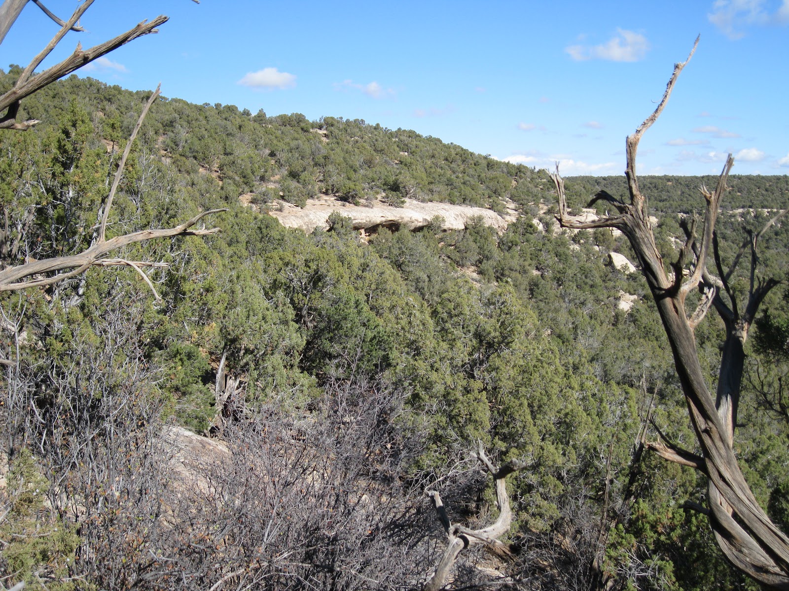
When hiking in the Canyons of the Ancients, it is helpful to scan the cliffs and hilltops with binoculars as these hidden sites will be sometimes visible from the distance. I started this hike 2.2 miles south of the carbon dioxide gas plant that is located at the junction of County Roads U and 14, west of the community of Yellow Jacket northwest of Cortez, CO.

At this spot there are good views south over the wide and deep Yellowjacket Canyon. Looking the other way, to the northwest, there is a large boulder with rubble on top about 1 mile away. I had noticed this boulder from several angles on other hikes in this area.

There are two small drainages to cross to get to this site. After arriving at a point where there is a good overall view, I saw that there are actually three boulders with rubble ruins on top. The large south facing site overlooks the junction of the two small drainages and there are some rocky cliff outcrops at the junction.

Walking up canyon a short distance, there is an easy crossing and I visited the site from east to west. The first boulder site is the smallest and isn’t the one that is visible from a distance. There are several other boulders without rubble piles that can be climbed for different views.

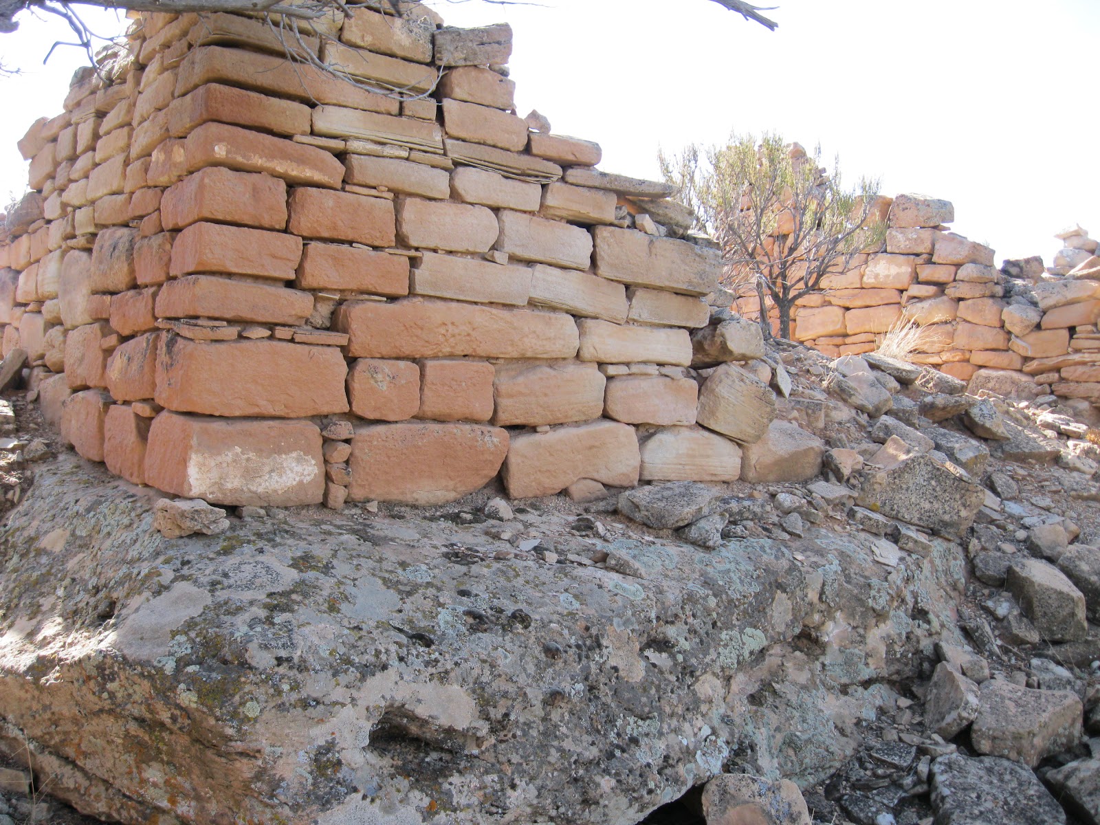
Between the first and second boulder ruins sites, there are some wall sections to find against the cliff walls. There is an unusual small structure with good quality bricks a short distance in front of the cliffs. One could guess this is some sort of storage but it is hard to tell.

The second boulder has a more substantial rubble pile on top and there is an adjacent boulder to climb on to get a good view. The Canyons of the Ancients area has many more of these boulder based structures that seem to be present at Mesa Verde and the Cedar Mesa area in Utah. I’ve wondered if the former presence of wolves in this area has anything to do with this. I’ve never seen any mention of wolves in the interpretive material that is widely available for this area.

Behind the third boulder there is a petroglyph of concentric circles. There are many vertical rock surfaces at this site, but this is the only rock art that I saw.

The third boulder has the most rubble of the three. This is the one that is visible from the distance.


Off to the side of the third boulder there is a retaining wall that is filled in with soil and provides a level and smooth area. This wall is positioned like a check dam and would have caught runoff water from the cliffs above. Most of the pottery shards that I saw in this area are in the drainage below this retaining wall.


I found a place to climb to the top of the cliffs where there is a good view of the rubble on top of the boulder and the overall site. Once on top, I decided to loop back toward my starting point, walking east along the cliffs. The road and the power lines along the main road are easily visible from the mesa top. I didn’t see any structures on top of the cliffs. It took me about 0:45 minutes to arrive at this site and I lingered here for 0:45 minutes.

The return hike taking the different route took 1:15 hours. On the way, up canyon from the three boulder based ruins, I found another boulder based site. I didn’t see any others structures associated with this site. My total hike took 2:45 hours for about 4 miles on a 52 F degree late November day.


Tuesday, November 29, 2011

Round Tower between Woods and Yellow Jacket Canyons

Yellow Jacket Canyon is one of the largest of the rugged Canyons of the Ancients in southwest Colorado. There is a hiking access on the north rim along the extension of County Road 14, south of County Road U. This area is west of the community of Yellow Jacket, northwest of Cortez, CO along highway 491.

From the trailhead area and Canyons of the Ancients sign in front of the carbon dioxide gas plant at Roads 14 and U, I continued driving south for 2.5 miles to a point where there are views along the north rim of Yellowjacket Canyon. The well maintained gravel road continues for about one mile to several carbon dioxide gas wells.

 I started hiking west along the canyon rim, parallel to the road and then turned north at the small gas facility building, and hiked past it and along the ridge behind it. After about 0:30 minutes of slow hiking, a large round tower is visible with binoculars below, as are the ridge top square towers across the drainage.

This large diameter tower seems to have an odd location. It sits on a rim above a drainage, but is at a relatively low location in the surrounding terrain. It has a clear line of sight to the pair of square towers that are on the ridge to the north. These square towers are more easily hiked to from the road to the west that is along the east rim of Woods Canyon.

I didn’t notice any other structures in the vicinity of this tower. It doesn’t seem to be part of a village or have a kiva connected to it.

Some of the rubble has spilled onto a level area below the tower. From the tower I continued downhill toward the drainage toward some cliffs that are below the square towers. This round tower is visible with binoculars from the Woods Canyon East Rim road if you stand in the right spot on the cliffs above the alcove ruins site. It is also visible from the square towers on the ridge.

There some alcoves in the cliffs below the square towers. I noticed a small wall fragment in one of the alcoves but didn’t try to get closer than viewing across the canyon.
From the cliff view I turned back south toward the gravel road and had some distant views of the round tower.

On the south side of this hill, there is a small ruins site on the rim and a large boulder overlooking the side canyon.

On the other side of this side canyon is the end of the gravel road and the beginning of a rougher trail that extends out to a rocky point.

I intersected the main gravel road about 0.7 miles from where I started. On this hilltop area close to the Yellowjacket Canyon rim, there is a rubble pile ruins site that I have visited before on the hike I called “Yellowjacket Canyon Close to Woods Canyon”.

There are at least three rubble pile sites along the Yellowjacket Canyon rim in this area. My total hike looping around the round tower took 3:00 hours on a 52 F degree late November day.


Wednesday, November 23, 2011

Square Towers between Woods and Yellow Jacket Canyons

On the east side of the Woods Canyon East Rim Road there is an alcove Ancestral Pueblo ruins site below the rim. From the cliffs above the alcoves, I thought I could see some wall structures hidden by the forest on a ridge in the area between Wood Canyon and Yellowjacket Canyon about 1 mile away.


The Woods Canyon East Rim Road is a west turn 0.2 miles past the carbon dioxide gas plant that is at the junction of Roads U and 14, west of the community of Yellow Jacket in southwest Colorado. I started hiking 1.1 miles down this road at a carbon dioxide well site.

Along the road here, to the west are good views of the Woods Canyon Pueblo site. From this starting point, the hiking is generally south along canyon rims with a crossing of one small drainage. There isn’t a trail to follow here. From previous observation from the cliffs above the alcoves, I had a good bearing on the hill I was heading for and used a compass to stay on course in the forest when there wasn’t good visibility.

The site sits on a narrow ridge with good views north and south, but isn’t visible from the east approach until you are 10 feet from it. It appears to be two side by side square towers with some south facing rooms below the towers.
This site has a good line of site view to the alcove sites. It is also visible with binoculars from the road that runs along the north and west rim of Yellowjacket Canyon.

There is more standing wall here than is usually visible at these remote sites. The bricks seem to be cut very square and fitted together well.

This doesn’t appear to be a village where many people could live. I didn’t see any kivas or other structures besides the towers and the rooms below. It is positioned with great visibility. It is in the middle between sites along Woods Canyon and others closer to Yellowjacket Canyon.


There is a little more room on the ridge top to continue west to views toward Yellowjacket Canyon and then view the ruins site from a different angle.


It took me 1:00 hour to arrive at this site and I lingered in the area for 1:10 hours. My return hike took 1:20 hours for a total hike of 3:30 hours. I carried and drank 2 liters of water on a 56 F degree late November day. There might be some minor sites to keep an eye out for in the small canyon drainage that is along the way.


Wednesday, November 16, 2011

Woods Canyon East Rim Road-North

The Woods Canyon area of Canyons of the Ancients is west of the community of Yellow Jacket in southwest Colorado. From Highway 491, turn west on Road Y and south on Road 15.

About 0.2 miles south of the junction of Roads U and 14, a well maintained gravel road turns west and leads south for 6 miles along the east rim of Woods Canyon, eventually reaching an overlook point of the junction of Sandstone Canyon and Yellowjacket Canyon.

About 1.6 miles along this road, there is an unmaintained side road that runs parallel to the main road on the east side for about 1 mile. I started my hike at the north end of this side road and walked this segment without noticing any Ancestral Pueblo ruins sites.

There are several points where the road is close to the rim and allows some good views to the east. From the south end of the segment I turned east to find the canyon rim again. From this angle there are some alcoves visible in the second level of cliffs.

The alcoves are approachable, without a trail, from the south side. There aren’t very many alcove ruins sites in the Canyons of the Ancients. This is one of the bigger alcove sites that I have seen here.

There are a series of these small structures in the alcoves at the base of these cliffs. Rubble flows away from the alcoves down the slope.


These rooms all seem to be small. I didn’t notice any pottery shards or rock art around this site.

Below the alcoves, there are some large boulders. Often, large boulders form the foundation of ruins sites. In this case, there is a large rubble pile site near the boulders that doesn’t use the boulders as part of the structure.

The amount of stones used for this rubble pile site is probably greater than the entire alcove collection put together. Alcove sites are popular to visit as they are usually better preserved, but the rubble pile sites usually seem to be much larger and are more numerous in the Canyons of the Ancients.

I found a small gap in the cliffs to climb back to the rim, but this spot isn’t obvious and would be a tricky descent. The cliffs extend for a distance to the north, so the south side approach appears to be the easiest. From above, the rubble pile ruins site is visible. I didn’t see any rim top structures above the alcoves.

My total hike took about 2:00 hours for 2 miles on a 48 F degree mid November day. There is a mesa top ruins site along another side road about 1 mile south of this site. Both of these sites are close to the large Wood Canyon Pueblo site.

Wednesday, November 2, 2011

Mockingbird Mesa West Rim

The Mockingbird Mesa area in the Canyons of the Ancients is 8.5 miles south on County Road 12 from the junction with County Road BB, west of Pleasant View in southwest Colorado. The route zig zags and the road numbers change before arriving at the normally closed gate near a carbon dioxide gas plant.

Starting out to the south parallel to the main road, there is a cleared swath of Pinon and Juniper forest that leads about 0.5 miles to a rubble pile Ancestral Pueblo ruins site. Keep an eye out for it along the west edge of the cleared area. The site is not visible from the main road.

This site and another similar site that is on the east side behind the carbon dioxide plant are the easiest to find and visit in the north part of the Mockingbird Mesa area. From this site, I hiked directly west a short distance to the mesa top rim that overlooks Negro Canyon.

I arrived at the head of a side canyon. Scanning with binoculars, there is a rubble pile visible on the north side of the side canyon near the point. It took me a total of 0:45 minutes to arrive at the site.

 The first structure visible on the east side of the site looks like a square tower. A wall segment on one side is still standing with the outline of an adjacent side.

A lot of rubble has collapsed into the interior of the room and some is flowing down the slope.

Further along there is a small alcove that appears to be the center of the site. The thick roof of the alcove acts as a foundation as well as a roof. Inside the alcove there are some small preserved wall sections. Like many Canyons of the Ancients sites, this village is partly on the canyon rim and partly just below the rim.


The view from the site is toward the south along the west rim of Mockingbird Mesa. There is some private property on the floor of Negro Canyon. Scanning from here, I didn’t notice any more ruins sites.

I returned back along the rim and continued south to the second side canyon. The terrain on the second side canyon seemed similar but I didn’t notice any more sites. The second side canyon has an old road trail that crosses the floor and climbs the south side.

I considered descending and crossing below but decided to stay along the rim. On the south side the trail that crosses can be found connecting to the main road. This junction is just south of a cattle guard and a barbed wire fence, about 2 miles south of the gas plant. A short distance from the main road, this trail has a side trail that continues southwest.

I followed the southwest leading trail for 0:45 minutes through the forest until it arrived at a third long side canyon that angles back to the northeast. I looked along the rim of this side canyon for about 1:00 hour but didn’t notice any ruins sites.

Following along the rim led back toward the main road. This part of the hike between the second and third side canyons turned out to be a loop. The return hike along the main road took about 0:45 minutes. My total hike took 5:25 hours for 9 miles. I carried and drank 3 liters of water on a 60 F degree late October day.