Saturday, November 3, 2012

Bridge Canyon South of Holly Ruins


The Holly Ruins Group is one of the outlying sites of Hovenweep National Monument in southwest Colorado. The rough road leading to the Holly and Horseshoe Units appears on the Canyons of the Ancients map as Road 4721 and is about 5 miles north of the Hovenweep Visitor Center along County Road 10.


A short distance south of the Holly Ruins there is a junction with BLM Road 4723 turning south and Road 4721 continues southeast. Road 4723 is marked as closed to motorized vehicles. I started near this junction and followed Road 4723 along the mesa top area between Bridge Canyon on the east and Keeley Canyon on the west.
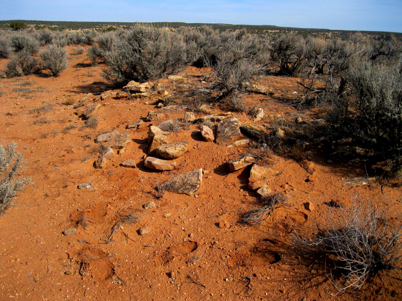

The road follows closely along the west rim of Bridge Canyon. After about 0:20 minutes of hiking I saw a small rubble pile near the rim. This site doesn't look like much but there are some pottery shards here so it is probably something.


 The mesa top area between Bridge and Keeley Canyons is a broad rolling field of sage brush. One can imagine that this was once a broad farming area used by the residents of the nearby Holly and Hackberry sites. At a few points along the trail the Headquarters for Hovenweep Monument is visible, with even the Hovenweep Castle visible despite being about 3 miles away.


About 2 miles south there was a rocky boulder area that looked like a good location but I didn't see any ruins structures there. There were good views down Bridge Canyon toward the Cannonball Mesa Area.


The road appears to continue for at least another mile. I turned around here after 1:30 hours. There is good visibility here and I didn't see any other ruins sites in the distance. From here I walked back northwest through the sagebrush fields toward a ruins site that was closer to the Keeley Canyon side of the mesa top.


From my turnaround point it took 0:45 minutes to arrive at this site. There appears to be a circular rubble pile around a depression with an odd stack of neatly piled stones. Some of the towers of the Holly site are visible across Keeley Canyon.


The stack of building stones acts a marker that makes this site more visible from a distance. I have noticed other tall rock cairns in this area but they didn't seem to be associated with ruins sites.


From this ruins site it took 0:30 minutes to return to the junction of roads 4721 and 4723. Along the way, there were across the canyon views of the Holly Ruins towers. My total hike took 3:00 hours for about 4 miles. I hiked on a 66 F degree early November day and carried 3 liters of water.


Friday, October 19, 2012

Hovenweep Canyon NW of Painted Hand Pueblo


The trailhead for the 0.75 mile Painted Hand Pueblo Trail is about one mile down the marked bumpy dirt road that is about 10 miles north of the Visitor Center for Hovenweep National Monument along County Road 10.

This area is west of Pleasant View in southwest Colorado and close to the border with Utah.  The trail to the outlying Cutthroat Castle Pueblo is about 0.5 miles further along the same road.


The first segment of trail to the Painted Hand Pueblo is along the west rim of Hovenweep Canyon. On this hike, I continued much further along the rim well past the Painted Hand site. About 0:15 minutes further there is a boulder based ruins site visible below the rim.

On the Hovenweep Canyon floor there is a trail that appears on the Canyons of the Ancients map as Road 4531f and it is open for hikers, horses, and bicycles. The two side canyons on the east side in this area both have medium sized Ancestral Pueblo ruins sites.


After about 1.5 miles, there is a side canyon where I had to descend to the floor to avoid private property that is close to the canyon rim. In this area, the canyon floor has some charred trees but is otherwise grassy. Near the head of this side canyon I noticed a large white sandstone rock outcrop that looked like it had some alcoves and I climbed back up.


This rock outcrop looked like a good location and I saw some pottery shards here, but I didn't see anything that looked like a ruins structure.


Continuing on for about 1.5 more miles I arrived at a very scenic lookout point. A rock positioned on the point was directed at the LaPlata Mountains, visible faintly in the distance to the east. This is probably a rarely visited point and this rock has probably been in this position for a long time. It certainly looks like it could be a solar observation point.


From this same view point, it looks like there is an isolated tower further north on the canyon floor.


Looking to the west up a side canyon, there is an obvious large ruins site, overgrown with sagebrush about 0.5 miles away. The cottonwood trees indicate there is water in the side canyon.


As I was resting and enjoying the view, I was surprised by two other local hikers accompanied by seven friendly dogs. These hikers knew that below this point, there were some turkey track petroglyphs and other markings that resemble the rock sharpening grooves that are often seen near ruins sites.


From the lookout point it took about 0:20 minutes to reach the large rubble pile ruins site. The site is at the head of the side canyon and is divided by one of the arms at the head into two parts. The rubble piles are very large but I didn't see that much was still intact.


The hikers that I met said that this is known as the Big Spring Pueblo site. I saw a surveying cap marker that had the number 5MT 7088.


From the ruins site I followed a cow trail down the side canyon, through a sagebrush field, to the main Hovenweep Canyon. This cow trail eventually connected with the main 4531f trail before it turns east toward Negro Canyon. So it is possible to walk on trails nearly all the way to the Big Spring site. The trail junction is faint but visible if you are looking carefully for it.


My return hike took 2:00 hours. I had to find a random place to climb back to the west rim before arriving at the Painted Hand site. The other option would be to continue the easy walking on 4531f to the Cutthroat Castle Trailhead. My total hike took 5:00 hours for about 7 miles. I hiked on a 60 F degree mid October day and carried 3 liters of water.


Saturday, September 29, 2012

Negro Canyon South of Painted Hand Pueblo


The Upper Trailhead for the Hovenweep Cutthroat Castle Trail can be used as a starting point for a hike to the west rim of Negro Canyon. This area is about 10 miles north of the Hovenweep Visitor Center along County Road 10 near the southwest Colorado and Utah border.

An old road that is labeled on the Canyons of the Ancients map as 4531f descends into Hovenweep Canyon and heads north.


As the road passes below the Painted Hand Pueblo ruins site, there is a side trail that climbs to the mesa top area between Hovenweep and Negro Canyons. It took me about 1:00 hour to arrive at the mesa top.


Along the canyon floor of the west side of Negro Canyon, there are at least three rubble pile ruins sites and there is also part of a circular tower on a ledge of the cliffs. (Use the Negro Canyon labels for views of these sites.)  On this hike I turned south and walked along the west rim of Negro Canyon. From this area, some of the power lines and gas plants on Mockingbird Mesa to the east can be sighted.


About 1 mile to the south there is a dog leg knife edge area leading to a sky island formation. These rocky points with good views are sometimes likely locations for ruins sites.


At the elbow of the dogleg, it looked like there was a boulder based ruins site in the area below the rim. I didn't notice any ruins sites in this area up to this point. I didn't walk out to the tip of the sky island. To get to the boulder below I had to backtrack to a low point along the knife edge to avoid the steep cliffs.


It took me about 0:30 minutes to arrive at the boulder from the rocky point above. There was a small amount of rubble visible on two levels of this pair of boulders. I was 2:50 hours into my hike when I arrived at this site.


On the east side, there was a short low wall of large boulders that form a small plaza. The creek bottom of Negro Canyon near this site has several Cottonwood trees growing, suggesting that there is some local water in this otherwise dry area.


It appeared that much of the rubble has fallen on the north side between the two boulders. These building stones appear to be more thin and flat than most of the ruins sites in the Canyons of the Ancients.


From this ruins site is a 5 minute walk east to the road that appears on the Canyons of the Ancients map as 4532. This road connects to the bicycle loop that passes by the Hackberry and Holly sites, so it is possible to bike to this site but not drive. It is difficult to pick this site out from the road. I followed road 4532 back north and then turned west and climbed back to the Negro Canyon mesa top and then returned the way I came on Road 4531f.

My return hike took 2:50 hours for a total hike of 6:00 hours for about 9 miles. I hiked on a 76 F degree late September day and carried 3 liters of water.


18407_$5 Shipping on Orders of $99 or More!

Thursday, September 27, 2012

Negro Canyon near NW Mockingbird Mesa


Mockingbird Mesa is located 7.2 miles south along County Road 12 from the junction with Road BB to a left turn. Continuing past this turn for 0.9 miles and turning left it is 1.3 more miles to a locked gate and the west side of the upper part of Negro Canyon.

This is the south end of the road labeled 4531a on the Canyons of the Ancients park map. This area is west of Pleasant View in southwest Colorado.


The only direction to hike at this point is to the west. There is a cleared swath of Pinon Pine and Juniper forest along a carbon dioxide pipeline. There is also an east and west fence close to the pipeline route. I followed the pipeline route west, crossing several minor drainages that appear to be side canyons of Negro Canyon.

After about 1.2 miles and 1:00 hour of slow walking I arrived at the minor dirt road that leads to the private Hovenweep Ranch. I had wandered off the pipeline route to look at the heads of the minor drainages in this area but didn't notice anything interesting.

The east and west fence along the north side of the Hovenweep Ranch is the same fence that is visible near my starting point and I decided to follow it back. There is a vague cow trail most of the way along the fence.


A short distance back east along the fence, there is a semi-circular rubble pile visible. This site is somewhat vague as a structure but there are many pottery shards visible scattered near the rubble.


One of the pottery shards was rectangular shaped and had a hole drilled into it. The area museums have displays of shards similar to this and they identify these as pendants. This is the first shard like this that I have noticed in the field. ( It is still there).


Continuing along the fence and crossing the low point of this drainage, then climbing up the east slope, there is another small ruins site with a small rubble pile and some large stones piled on a boulder.


This same site also had a large semi-circular structure that had higher walls and a deeper depression in front of it than the previous site . This structure might be a full circle, but the south side wasn’t as obvious as the north side.


This site also had many pottery shards. From this site it was about 0:30 minutes to return to the starting point. My total hike took 2:20 hours for about 2.5 miles. I hiked on a 66 F degree late September day.


532497_120 x 90 Starting Salary $42k. Group 1 18407_$5 Shipping on Orders of $99 or More! 544544_Travelation: More flights. Lowest price, guaranteed with no booking fees

Saturday, September 15, 2012

Hovenweep Canyon near Mockingbird Mesa 2


The Mockingbird Mesa area in the Canyons of the Ancients is south on County Road 12 from the junction with County Road BB for 7.2 miles and make a left turn at a BLM road junction. This area is west of Pleasant View, in southwest Colorado.

Staying to the right at the Mockingbird junction and right at the next junction for 1.5 miles arrives at a carbon dioxide plant near the east rim of the upper part of Hovenweep Canyon. There is a south leading dirt road trail before the gas plant that also leads into this area. On the Canyons of the Ancients map this road segment is 4531d, but I didn’t notice if it was marked in the field.


Walking west from the gas plant out to a point overlooking Hovenweep Canyon, there is a sagebrush canyon floor with a road that leads to a drill site. My hiking goal was to walk along the canyon rim and arrive at the canyon floor near the drill site, then look around the canyon floor area.


There are two large and interesting ruins sites in the side canyon area to the east of the rim where I was walking. (Use the label “Hovenweep Canyon near Mockingbird” for more views.) On this hike I was trying look further down the canyon beyond these sites.


Below the large ruins site and close to the rim, there is a large circular site. This looks like a large kiva but it the only structure in the immediate area, not part of a village as far as I could see. The large site is nearby, but higher along the slope.


I arrived at the canyon bottom in a narrow area with some large boulders on the west side. There was a cow trail to follow as I turned back toward the north. It took me 2:15 hours to arrive here after mostly slow walking with a lot of scanning with binoculars. This is about 2 miles south of where I started. There is a cleared area pipeline route that crosses Hovenweep Canyon in this vicinity.


Passing by drill site, there is an operating pump at the well and a rubble pile ruins site is visible on the cliff above. I didn’t try to climb up but it looks like a small lookout point site.


To the west of the drill site, across the sagebrush canyon floor, I could see two side by side boulders with some rubble on top. There is a deep eroded wash to cross and I had to look around for several minutes to find a reasonable place to cross. The sagebrush here is also very tall, thick and difficult to walk through.


There is a lot of rubble between the two boulders, both on the front side and behind. This appears to be a small site also, and it has a line of sight with the site across the canyon floor near the well site. This location is at a junction with a side canyon to the west of the main Hovenweep Canyon.


Continuing north along the west canyon floor, I noticed that there were many scattered pottery shards both in the Pinon Pine and Juniper forest and in the sagebrush field areas close to the canyon wall. I noticed one piece of red pottery. The area museums say that red ware was a product of Utah and Arizona and any found near the Mesa Verde area would have been traded in.


On the east side of the canyon floor there is another pair of boulders with rubble on top and scattered at the base. This site is about halfway from the starting point to the end of the road and is visible from the rim area.


From this site it looked relatively easy to climb back to the mesa top. This point is slightly south of the large ruins site that overlooks the side canyon to the east. From here it took me 1:00 hour to return to my starting point. My total hike took 5:00 hours for about 5 miles. It was a 68 F degree mid September day and I carried and drank 3 liters of water.


18407_$5 Shipping on Orders of $99 or More!