Sunday, September 25, 2011

Cannonball Mesa Cliffs Southwest

The southwest corner of Cannonball Mesa has a rocky point above high cliffs that overlooks the Ismay Pueblo and Petroglyph site. This area is on the southwest side of the Canyons of the Ancients area in southwest Colorado. The access is about 26 miles west of Cortez, CO along County Road G. A short distance east of the point, there is a south turnoff that leads to the Hamilton Mesa area.

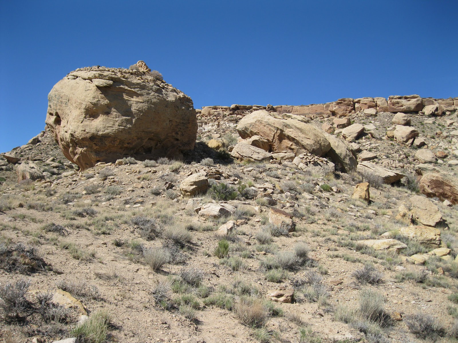
On the north side of County Road G, across from the turnoff, there is a short unmarked trail that climbs toward the south side cliffs. On a shelf area below the cliffs, the Ismay ruins site has a boulder based neighbor. This site is visible from the mesa top point, but isn’t visible from the road.

The boulder forms something of a rock shelter with a constructed room in front. There are remains of other rooms around the west side also.

From the backside there views of the wall segments on top of the boulder. The overall site is bigger than it appears at first. More rubble is behind the boulder and there are minor structures spread across the hillside. This terrain and environment here appears to be very dry but it is near the junction of McElmo Creek and Yellowjacket Creek, both with flowing water most of the year. The Cannonball Mesa area has several more ruins sites to search for.

On the east side of the boulder there is a petroglyph panel. I haven’t seen much rock art in the Canyons of the Ancients except here in the Cannonball Mesa area.

Some of the other nearby boulders have minor images also. There is a roadside boulder a short distance west of the trailhead that has easy to view rock art, but it is somewhat vandalized with recent graffiti. Some of the rock faces up above have initials inscriptions with dates from the 1930s.

I spent 1:20 hours visiting this site on an 82 F degree late September afternoon. The hiking distance is very short; most time is spent exploring the area. The Ismay Pueblo and Petroglyph site is just a short distance further west. It is probably possible to continue to the mesa top from this site. From the mesa top view I saw a notch in the cliffs above the ruins that can be hiked, but I thought it would be easier to visit from the road.


532497_120 x 90 Starting Salary $42k. Group 1 18407_$5 Shipping on Orders of $99 or More!

Friday, September 23, 2011

Hamilton Mesa Trail

Hamilton Mesa forms the south side of McElmo Canyon in the area where Cannonball Mesa forms the north side. This relatively dry area is the southwest corner of the Canyons of the Ancients in southwest Colorado. The trail is the unmarked BLM road that is a south turn from County Road G, 26 miles west of Cortez, CO. There is a roadside boulder with some petroglyphs about 100 yards west of this turnoff.

The Hamilton Mesa Trail is lightly used as it requires visitors to get across McElmo Creek, which carries irrigation water much of the year. I brought river sandals for the out and back creek crossings. In late September the water was knee deep with enough current that I used a long Tamarisk stick to help with balance and walked carefully. The footing was firm on the mostly rocky bottom. It reminded me of the creek crossings on the popular hikes at Mill Creek in Moab, Utah.

The trail heads south for about 1 mile along the west side of Hamilton Mesa and then turns east and follows the south side. There are large power lines crossing the area near the trail. After about 2 miles, there is a fence with a gate at a large inlet on the south side of the mesa.

The canyon area on the south side is very wide and very dry with only grasses and scattered shrubs growing. I was walking slowly and scanned the cliffs for Ancestral Pueblo ruins sites but didn’t notice anything.

The road continues into the distance along the floor of the mostly featureless canyon. I crossed through the gate and walked up the draw. There appeared to be a place to climb to the mesa top. Once up on top, there is a lot of level area to explore. There are more Juniper trees on top but it is still a dry environment.

The Hamilton Mesa top isn’t very wide and it is easy to walk to the north rim for views across the green irrigated bottom of McElmo Canyon. There is a road on the mesa top that leads to the east. It is probably possible to walk up on the mesa top using the road system rather than climb up like I did.

There are good views in the area where I hiked but I didn’t find any ruins sites. My total hike in the Hamilton Mesa area took 4:30 hours for about 6 miles. The small scale maps for this area at the Anasazi Heritage Center show some archaeology sites for this area and there is lot more area to explore. I carried and drank 3 liters of water on a sunny late September day that was 60 F at 9:45 AM and 82 F at 2:15 PM.

Tuesday, September 6, 2011

Pedro Point South

The Pedro Point road leads to one of the easiest to find unpublicized Ancestral Pueblo ruins sites in the Canyons of the Ancients National Monument in southwest Colorado. The route follows the BLM dirt road marked 4720 west.

This road is a west turn, about 1.4 miles south of the turnoff for the Painted Hand Pueblo along paved County Road 10, and about 8 miles north of the Visitor Center for Hovenweep National Monument.
On this hike I was looking in the area south of the Pedro Point Road about half way to the well known ruins site. I drove the first 0.6 miles to the point where there is a good overlook to the north into the McLean Basin, then starting hiking along the road, but mostly looking at the heads of the large side canyon on the south side of the road.

After about 25 minutes and 0.8 miles, I turned south and followed along the west rim of the long side canyon.

After less than 0:10 minutes of hiking, I noticed a tall rubble pile within about 100 feet of the canyon rim. There is a second smaller rubble pile on the west side.

There isn’t much definition to the rubble pile combination. These two structures seem to be isolated, about 1.5 miles southeast of the large Pedro Point site.

There were many pottery shards associated with this site. I mostly saw plain white pieces and corrugated with a few painted designs.

I continued west through a wide sage brush field without seeing any other sites, then turned north and intersected the Pedro Point Road about 0.8 miles east of the large Pedro Point site. Near where I found the road there is a small rubble pile close to the south side of the road. This site would probably not be noticed if you are driving but hikers should see it.

The return hike to my starting point took 0:40 minutes for about 1.6 miles. My total hike took 1:45 hours for about 4 miles. It was an 80 F degree early September morning. I carried and drank 2 liters of water.

There are viewpoints along the Pedro Point Road into the wide McLean Basin. The elusive McLean Basin Towers are visible with binoculars below some cliffs toward the northeast side of the basin.


Tuesday, August 30, 2011

Side Canyons east of Lower Cross Canyon

In the central part of the Canyons of the Ancients in southwest Colorado, the lower part of Cross Canyon, south of Pedro Point, has several east side canyons that don’t seem to have names.

 In this area, there is a loop road that is an established mountain bike route.  The loop has a starting point near an old corral that is about one mile north of the turn off to the Holly and Hackberry outlying Hovenweep National Monument sites, along County Road 10. This corral area is also about 3.6 miles south of the turn off for the Painted Hand Trail.

Across County Road 10 from the old corral, there is a dirt road trail that leads northwest. I followed this trail for 0.3 miles to a junction with another road trail that is closed to vehicles. At this junction, there is a rock outcrop with many large boulders sliding down the hillside.

Near the base of this rocky hill there is a rubble pile Ancestral Pueblo ruins site. I was only a few minutes into my hike when I noticed this site, a good start.

A collection of boulders is usually a good place to look further. Up near the rim, there is a very small alcove with a small structure. Other than the Sand Canyon area, there aren’t very many alcove sites in the Canyons of the Ancients.
At this trail junction, there is a choice of continuing to the northwest, or turning left and going mostly southwest, toward a rim area with overlooks of the lower Cross Canyon area. I turned left. I was able to continue for about 0:45 minutes, scanning the side canyons with binoculars.

There are a lot of good canyon views, but I didn’t see any more ruins in along this segment of trail. I returned back toward the junction and could have ended my hike after about 2:00 hours. But I cut north across the canyon head and looked a little further to the north and east.

There is a very long side canyon that extends northeast all the way to the south side of the Pedro Point area. I hiked along this south rim of this long side canyon and for a while I was back on the established trail, which seems to end at the rim.

I used a compass and started to hike southeast back toward my starting point when I came across a large semi-circular ruin structure. This site seemed to have a curious location. It wasn’t very close to the canyon rim or on a hilltop.The concept of shrines is somewhat vague, but this might be one. This site might be hard to find again. Looking east from the site, I could see vehicles on the paved Road 10 about 0.5 miles away, and the old corral is about 1 mile to the south.

There was lot of pottery visible at this site, including a few of the largest shards I’ve seen. There might be a small check dam across a small wash near the site. Check dams are easy to see when they are pointed out at Mesa Verde, but I don’t seem to see them in the backcountry areas.

Associated with the large circular structure was a site with several flat rocks turned on end. The interpreted sites at Mesa Verde describe rocks like these as possibly being the lining of underground food storage structures. From this site it took me 0:50 minutes to return to the old corral. My total hike took about 4:00 hours for about 8 miles. It was 72 F degrees at 9:20 AM and 86 F degrees at 1:30 PM on a late August day. I carried and drank 3 liters of water.


Friday, August 26, 2011

Pedro Point Southeast

The Pedro Point road leads to one of the easiest to find of the unpublicized Ancestral Pueblo ruins sites in the Canyons of the Ancients National Monument in southwest Colorado.

The Pedro Point route follows the BLM dirt road marked 4720 west. This road is about 1.4 miles south of the turnoff for the Painted Hand Pueblo along paved County Road 10, and about 8 miles north of the Visitor Center for Hovenweep National Monument.


About 0.25 miles south of the Pedro Point Road, there is a cattle guard and a sign that says “No Blading in Barrow Ditches between Signs.” The reason for no blading is the rubble pile ruins site that is very close to the road.

If you don’t hike to any of the hundreds of wild ruins sites while visiting the Canyons of the Ancients, you can at least see this one driving by. I started my hike by visiting this site and continued hiking southwest, using a compass as there aren’t any old roads or trails to follow. The walking is easy through sagebrush with scattered Utah Juniper trees. About 1 mile southwest is an obvious rocky hilltop that I headed for.

I didn’t notice any ruins on this hilltop despite seeing a number of pottery shards that had washed down the drainages. Looking north, there is another rocky hilltop between the one I was on and the Pedro Point road hilltop. I had good luck there later.

After about 1:15 hours of hiking to the southwest, I came across a trail that leads northwest. This trail looked like a mineral exploration trail. I decided to follow it until it seemed to fizzle out at the drainage between the two hilltop areas. Looking at Google maps, this trail looks like it connects with County Road 10 further south. There was more pottery visible in the washes through this area, but I didn’t see any ruins sites.

While traveling north and east across the drainage, I spotted a fairly large site on the south side of a hilltop that overlooks a junction of large drainages. The site was mostly on the rim and spilled down below the rim. There are a couple of places where the brickwork is still mostly intact. I was 2:00 hours into my hike when I arrived at this site.


The site has a good view down canyon to the southwest. Some of the formations in the northern part of the Navajo Reservation were visible in the distance, like Black Mesa.


Much of the rubble material had spilled downhill with a few bricks still standing. On the way to this site, I walked over a very small rubble pile site in the small valley directly south. That site was obscured by sagebrush so well that I was walking on it when I noticed it. It would be hard to find it again, but it is in easy range of this larger ruins site.

It took me about 1:15 hours to return to my starting point close to the beginning of the Pedro Point Road. This ruins site is about 1.5 miles west, more or less, of the junction with County Road 10 and about 0.5 miles south of the Pedro Point Road. There are no trails around this site and it doesn’t appear to get many visitors.


Hiking north and east I intersected the Pedro Point Road close to the rubble pile ruins site that is in the first mile from the junction with County Road 10. This site might not be noticed if you drive to the large Pedro Point site but should be noticeable to hikers.


My total hike took 3:15 hours for about 4 miles of mostly slow hiking. On a late August day it was about 75 F degrees at 9:30 AM and about 88 F degrees at 12:45 PM. I carried and drank 3 liters of water.